Category: Series: Zoning

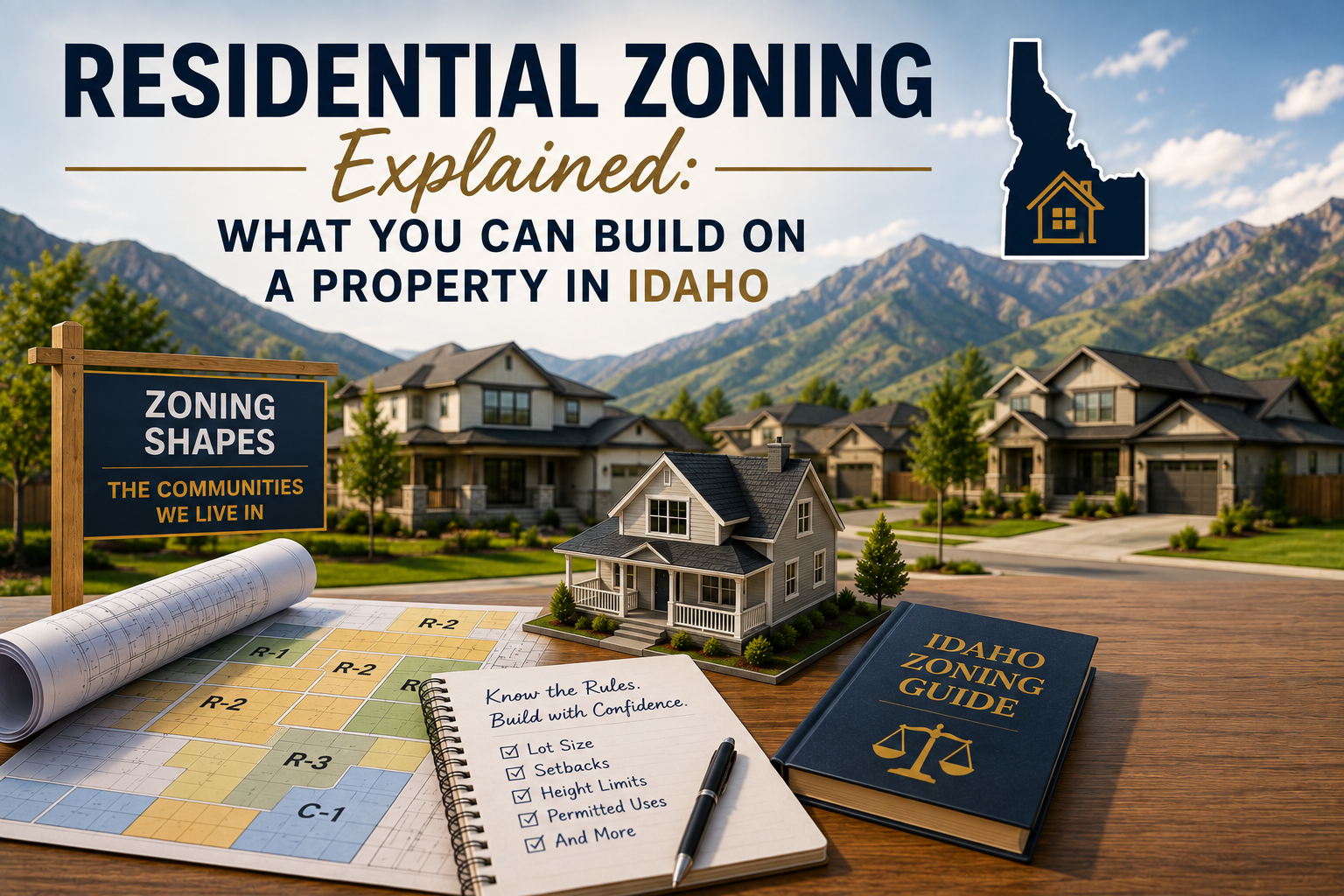
  • Residential Zoning Explained: What You Can Build on a Property in Idaho

    Residential Zoning Explained: What You Can Build on a Property in Idaho

    (Zoning Series – Part 1)

    Residential zoning in Idaho affects far more than whether a property can have a house on it. Zoning can determine what type of home you can build, how many housing units may be allowed, where structures may be located on the property, how tall they may be, and what other uses may be permitted.

    That makes residential zoning one of the first things buyers and property owners should understand before designing a home, purchasing land, adding another dwelling, or planning future improvements.

    Two properties can both be considered residential and still have very different development potential.

    This article is the first in our zoning series. We’ll start with residential zoning: what it means, what it can regulate, and why understanding the rules early matters when buying or building in Boise and throughout the Treasure Valley.

    What Is Residential Zoning in Idaho?

    Residential zoning is a land-use classification used by cities and counties to identify areas intended primarily for housing.

    At a basic level, residential zoning helps communities manage things such as:

    • Housing density
    • Building placement
    • Neighborhood development patterns
    • Access to roads and infrastructure
    • Compatible land uses
    • Building size and height

    However, residential zoning in Idaho is not one universal set of rules.

    Boise, Meridian, Eagle, Kuna, Nampa, Caldwell, Ada County, and other local jurisdictions establish their own zoning districts and development standards.

    That means simply seeing the word “residential” on a property listing or zoning map does not tell you everything you need to know.

    You need to identify the property’s specific zoning district and then review the regulations that apply to it.

    Common Types of Residential Zoning Districts

    Residential zoning districts generally allow different levels and forms of housing.

    The exact names and regulations vary by jurisdiction, so buyers should not assume that an R-1 designation in one community means the same thing elsewhere.

    Still, residential zoning typically progresses from lower-density neighborhoods to more compact or urban development.

    Lower-Density Residential

    Lower-density residential districts are generally intended for homes on larger lots with more space between structures.

    Depending on the jurisdiction, these areas may emphasize:

    • Detached homes
    • Larger lot sizes
    • Lower overall housing density
    • Larger yards or setbacks
    • Less intensive development

    For someone purchasing land to build a custom home, this type of zoning may sound ideal.

    But a larger lot doesn’t automatically mean unlimited building potential. Setbacks, easements, overlays, utilities, topography, and other requirements can still reduce the usable portion of a property.

    Moderate-Density Residential

    Moderate or compact residential districts may allow a broader mix of housing types or smaller lots.

    Depending on local regulations, development could include:

    • Detached homes
    • Duplexes
    • Townhomes
    • Accessory dwelling units
    • Other forms of attached or compact housing

    The important word is may.

    The zoning district is only the starting point. The property itself still has to meet applicable dimensional standards, access requirements, parking rules, and other development regulations.

    Higher-Density or Urban Residential

    More urban residential districts are generally designed to accommodate greater housing density.

    Depending on the location and zoning code, these areas can support housing forms such as:

    • Attached homes
    • Townhouses
    • Apartments
    • Condominiums
    • Multi-unit residential buildings

    At greater densities, factors such as building height, parking, access, landscaping, setbacks, lot dimensions, and design standards may become especially important.

    For buyers and investors, this is why zoning should be evaluated based on the actual property rather than the zoning category alone.

    What Does Residential Zoning Actually Regulate?

    The biggest misconception about residential zoning is that it only answers one question:

    Can I build a house here?

    In reality, residential zoning rules help define the property’s buildable envelope—the portion of the property where development can realistically occur and what that development can look like.

    Several rules can shape that envelope.

    Permitted Uses

    Every zoning district establishes which uses are allowed.

    Depending on said property and local zoning code, permitted residential uses usually include:

    • Detached homes
    • Duplexes
    • Attached housing
    • Accessory dwelling units, or ADUs
    • Certain home occupations
    • Multi-unit housing
    • Accessory structures

    Other uses may require additional approval or may not be permitted at all.

    This distinction matters when buying property for a specific goal.

    If you’re purchasing a lot because you plan to build a house plus an ADU, for example, you should verify that the complete plan works under the current rules rather than assuming residential zoning automatically allows it.

    Density and Lot Size

    Density determines how much residential development may occur within a particular area.

    Depending on the zoning district, regulations can address:

    • Minimum lot size
    • Lot width
    • Number of dwelling units
    • Housing density
    • Building type

    This is particularly important for investors or buyers considering multiple dwelling units.

    A large parcel is not automatically entitled to multiple homes simply because there appears to be enough physical room.

    Zoning standards, access, infrastructure, subdivision requirements, easements, and site conditions can all affect what is actually possible.

    Zoning Setbacks: Where Can You Build?

    Zoning setbacks establish how far a building must generally be positioned from property lines, streets, or other features.

    Properties may have separate requirements for:

    • Front setbacks
    • Rear setbacks
    • Interior side setbacks
    • Street-side setbacks

    These requirements can have a major impact on a property’s usable building area.

    Imagine a narrow or oddly shaped lot. On paper, the total acreage may appear more than adequate for a home. Once required setbacks and other restrictions are applied, the area available for construction can become much smaller.

    Corner lots, irregular parcels, and properties with unusual access could require even closer review.

    Building Height

    Residential zoning may also establish maximum building heights.

    Height becomes particularly important when designing:

    • Multi-story homes
    • Homes on sloped properties
    • Taller rooflines
    • Attached housing
    • Multi-unit residential buildings

    The way height is measured can also matter.

    That is one reason buyers should avoid relying on assumptions such as “a two-story house should fit.” A design still has to comply with the specific standards that apply to the parcel.

    Lot Coverage and Building Size

    Some residential zoning rules regulate how much of the lot can be covered by buildings or how building area relates to the overall property.

    These regulations can limit the size or footprint of:

    • The primary residence
    • Garages
    • Accessory structures
    • Other improvements

    A buyer may find a lot with the right acreage and zoning classification but discover that the desired home design occupies too much of the available building area.

    This is another reason zoning analysis should happen before plans become too detailed.

    ADUs and Additional Housing

    Accessory dwelling units have become an increasingly important consideration for residential property buyers.

    An ADU might be used for:

    • Extended family
    • Guests
    • Additional living space
    • Long-term housing
    • Other uses permitted by local regulations

    However, buyers should verify the current requirements for the specific jurisdiction and property.

    Zoning may address the size, placement, access, parking, ownership, or design of an ADU.

    Do not assume that because a neighboring property has an accessory dwelling, the same development is automatically allowed on another parcel.

    Easements Can Reduce the Buildable Area

    Zoning approval does not erase easements.

    A property may contain recorded areas reserved for:

    • Utilities
    • Drainage
    • Access
    • Irrigation
    • Roads
    • Other public or private purposes

    An easement can cross an otherwise ideal building location and significantly change the layout of a future home.

    This is why zoning maps should be reviewed alongside surveys, plats, title information, and other property records.

    Overlay Zones Add Another Layer

    Base residential zoning may not be the only zoning affecting a property.

    Some properties are also located within overlay zones, which add additional requirements because of particular environmental, design, historic, or safety considerations.

    Depending on the location, overlays may address issues such as:

    • Flood hazards
    • Hillside development
    • Wildland-urban interface areas
    • Historic or neighborhood character
    • Airport influence
    • Sensitive lands

    A property can therefore meet the requirements of its residential zoning district and still face additional restrictions from an overlay.

    We cover these additional layers in more detail later in this zoning series.

    HOA Rules and CC&Rs Are Different From Zoning

    Another common source of confusion is the difference between government zoning regulations and private neighborhood restrictions.

    Homeowners associations and recorded CC&Rs may establish rules involving:

    • Architectural design
    • Exterior materials
    • Paint colors
    • Minimum home size
    • Roof design
    • Fencing
    • Garage placement
    • Landscaping
    • Accessory structures

    These private restrictions are separate from municipal or county zoning.

    A local zoning code may allow something that an HOA prohibits.

    For that reason, someone buying property in a planned community should evaluate both the applicable zoning rules and any private restrictions affecting the property.

    Why Residential Zoning Should Be Reviewed Before You Buy

    Residential zoning becomes especially important when you’re purchasing a property because of what you hope to do with it in the future.

    Before buying, ask questions such as:

    • What is the property’s exact zoning district?
    • What housing types are allowed?
    • Can I build the type and size of home I want?
    • Could an ADU or additional dwelling be allowed?
    • What setbacks apply?
    • Are there easements affecting the building area?
    • Is the property within an overlay district?
    • Are there HOA or deed restrictions?
    • Will utilities and access support the proposed development?
    • Are there other approvals I would need before building?

    Answering those questions early can prevent expensive surprises after closing.

    Residential Zoning Doesn’t Tell the Whole Story

    Residential zoning is one piece of a larger property-development puzzle.

    The zoning classification tells you a great deal about how a parcel may be used, but a complete evaluation can also involve:

    • Surveys and plats
    • Easements
    • Title documents
    • Utility availability
    • Road access
    • Topography
    • Flood or hillside restrictions
    • HOA documents
    • Building codes
    • Local approval requirements

    This is why two residential lots sitting next to each other can have surprisingly different development potential.

    Buying Land or Planning a Custom Home in the Treasure Valley?

    If you’re searching for land or a property for a future home, understanding zoning before you buy can help you eliminate properties that don’t fit your plans and focus on the ones that do.

    Sunrise Realty Group’s approach combines real estate knowledge with an understanding of the custom-home process, helping buyers look beyond the listing and think about how the property fits their larger vision.

    Our 3-One Method creates one clear path from finding the land to designing the home, connecting with the right builder, and moving toward closing.

    If you’re considering land or a custom home in Boise or elsewhere in the Treasure Valley, start the conversation before you commit to the property.

    Because the best time to discover what you can build isn’t after you buy the land.

    It’s before.
    Learn how residential zoning in Idaho affects density, setbacks, building height, ADUs, easements, and what you can build on a property.
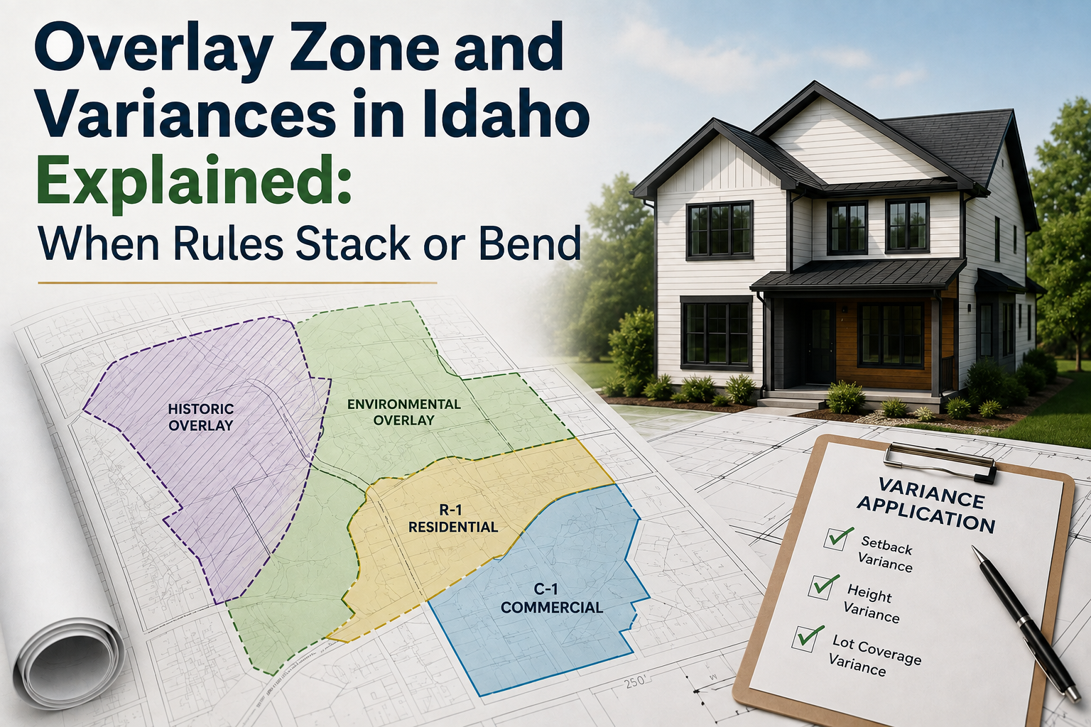
  • Overlay Zones and Variances in Idaho Explained: When Rules Stack or Bend

    Overlay Zones and Variances in Idaho Explained: When Rules Stack or Bend

    Zoning Series — Part 5

    Overlay zones and variances can change what is possible on a property, even after you understand the base zoning.

    That is the part that catches many buyers off guard.

    Once someone learns a property is residential, agricultural, commercial, or mixed-use, it is easy to assume the main zoning question has been answered. Sometimes it has. Often, it has not.

    Base zoning is only the starting point. A property may also be affected by overlay zones, conditional uses, special exceptions, variance standards, private restrictions, environmental limits, or site-specific approval conditions.

    Some of these rules add extra requirements. Others create a narrow path for requesting relief from a rule. Either way, this is where zoning becomes more layered, more discretionary, and sometimes less predictable.

    For buyers, builders, and investors in Boise, the Treasure Valley, or elsewhere in Idaho, this layer matters. It can affect design, cost, timeline, financing, and whether a project is realistic at all.

    This article explains how overlay zones and variances work, what special exceptions and conditional uses mean, and where people most often get tripped up.

    What Are Overlay Zones and Variances?

    Overlay zones and variances both affect zoning, but they do very different things.

    An overlay zone adds rules on top of the base zoning district. It usually applies because the property is in a specific mapped area, such as a floodplain, hillside, fire-risk area, historic district, or design review district.

    A variance is different. A variance is a request for limited relief from a specific zoning standard, usually because the property has a unique hardship or physical constraint.

    In simple terms:

    Overlay zones add rules.

    Variances ask for a narrow exception from rules.

    That difference matters because buyers sometimes treat both as small details. They are not. Either one can change the entire feasibility of a project.

    Overlay Zones: When Extra Rules Sit on Top of Zoning

    An overlay zone is an additional regulatory layer that applies on top of the underlying zoning district.

    It does not replace base zoning. It stacks on top of it.

    That means a property usually has to comply with both:

    • The base zoning rules
    • The overlay zone rules

    When the rules conflict, the more restrictive requirement often controls.

    For example, base zoning may allow a home on a lot, but a floodplain overlay may limit where that home can sit. Base zoning may allow a certain building height, but a hillside overlay may measure height differently or limit grading. Base zoning may allow alterations to a building, but a historic overlay may require special design review first.

    This is why buyers should never stop at the zoning label alone. The zoning district tells part of the story. The overlay may tell the rest.

    Why Overlay Zones Exist

    Overlay zones are usually created to address conditions that standard zoning does not handle well on its own.

    They may be used to protect:

    • Flood-prone areas
    • Hillsides and steep slopes
    • Wildfire-risk areas
    • Rivers, wetlands, or sensitive lands
    • Historic neighborhoods
    • Airport influence areas
    • Community character
    • Public infrastructure
    • Pedestrian or transit corridors

    The goal is not always to stop development. Many overlays allow development, but only if the project meets extra standards.

    That can mean more studies, more engineering, more design review, more inspections, or more conditions before approval.

    For a buyer, that means the property may still be buildable, but the path may be more expensive or more complicated than it first appears.

    Common Types of Overlay Zones in Idaho

    Overlay zones vary by city and county, but several types come up often in Idaho land and building conversations.

    Floodplain and Floodway Overlays

    Floodplain and floodway overlays regulate development in areas that may be affected by flooding.

    These rules may affect:

    • Building location
    • Finished floor elevation
    • Use of fill
    • Foundation design
    • Floodproofing
    • Insurance requirements
    • Whether certain structures are allowed at all

    Floodway areas are especially important. A floodway is generally the part of the floodplain that carries floodwater. As a result, development may be heavily restricted or prohibited.

    A property may look buildable online, but if the best building area lies within a floodplain or floodway, the project may require additional review before anyone can rely on that assumption.

    Hillside or Steep-Slope Overlays

    Hillside and steep-slope overlays are common in areas where slope, erosion, drainage, landslide risk, or visual impact matter.

    These overlays may regulate:

    • Grading
    • Slope disturbance
    • Retaining walls
    • Driveway grades
    • Foundation design
    • Building height
    • Tree removal
    • Drainage
    • Visual impact from surrounding areas

    This can become a major issue for foothill lots, view lots, and custom homes.

    A buyer may love the view and assume the home can be placed at the highest or most dramatic point on the property. The overlay may say otherwise.

    In some cases, the home can still be built, but it may require a different footprint, engineered grading, special drainage, or a more careful site plan.

    Wildland-Urban Interface and Fire-Risk Overlays

    Wildland-Urban Interface areas are places where homes and development meet open land, brush, foothills, forests, or other fire-prone landscapes.

    These areas can create additional fire-safety concerns. Depending on the jurisdiction and property, the rules may affect:

    • Road width
    • Emergency vehicle access
    • Turnarounds
    • Defensible space
    • Fire-resistant materials
    • Water supply
    • Fire suppression
    • Landscaping
    • Driveway length or grade

    These requirements can change both design and cost.

    A property may allow the intended use under base zoning, but fire access or water supply requirements may still make the project harder to approve.

    Historic or Design Overlay Districts

    Historic and design overlays are often used to protect neighborhood character, architectural patterns, or important community areas.

    These overlays may regulate:

    • Exterior materials
    • Roof forms
    • Window proportions
    • Building additions
    • Demolition
    • Front porch design
    • Siding
    • Site layout
    • New construction compatibility

    This matters because zoning may allow a use, but the overlay may control how the building looks or whether certain changes are allowed.

    For example, a property owner may be allowed to use a building as a residence, but not be allowed to remove historic exterior features without review. A buyer may be able to build an addition, but only if the design fits the district standards.

    Variances: Limited Relief From Zoning Rules

    A variance is a formal request to deviate from a specific zoning standard.

    It is not a shortcut. It is not a workaround for poor planning. It is not a guarantee.

    Variances are usually intended for unusual property conditions where strict application of the zoning rule would create a hardship not shared by most other properties in the area.

    Common examples may involve:

    • Setbacks
    • Lot width
    • Lot depth
    • Height
    • Lot coverage
    • Building placement
    • Parking layout

    A variance does not change the zoning district. It grants only narrow relief under a specific standard if the approving authority agrees that the legal criteria have been met.

    That distinction matters. A variance is not the same as rezoning.

    What a Variance Usually Cannot Do

    One of the biggest mistakes buyers make is assuming they can “just get a variance” if the zoning does not work.

    That is risky.

    In many zoning systems, variances are not intended to allow a use that is completely prohibited. They usually cannot be used to rewrite the zoning district’s basic purpose, dramatically increase density, or override the code’s intent.

    For example, if a zoning district does not allow a particular commercial use, a buyer should not assume that a variance will solve the problem. If the project requires a use not allowed, the path may require a different type of approval, a conditional use process, or even rezoning.

    That is a much bigger deal than adjusting a side setback.

    The Legal Standard for Variances

    Variance standards vary by jurisdiction, but the general idea is similar.

    The applicant usually has to show that the property has something unusual about it and that strict application of the zoning standard creates a hardship.

    That hardship might relate to:

    • Lot shape
    • Lot size
    • Topography
    • Existing structures
    • Physical constraints
    • Conditions not created by the owner

    Financial inconvenience alone is usually not enough.

    In other words, “I would make more money if this were approved” is not the same as a zoning hardship. “I prefer this design” is not the same as a zoning hardship either.

    The applicant may also need to show that the variance is the minimum relief necessary and that it will not harm neighboring properties, public safety, or the zoning code’s intent.

    Why Variances Are Risky

    Variances are risky because they are discretionary.

    That means an applicant can apply, provide evidence, attend hearings, and still be denied.

    Variances may involve:

    • Formal applications
    • Public notice
    • Staff review
    • Public hearings
    • Neighbor comments
    • Conditions of approval
    • Appeals

    Approval can depend on the facts of the property, the strength of the application, the local code, staff analysis, public input, and the reviewing body’s decision.

    That is why designing a project that depends on a variance is not the same as designing a project that complies with the rules as written.

    If the project only works with variance approval, buyers should treat that as a real risk.

    Conditional Uses and Special Exceptions

    Some zoning codes use terms like conditional use, special exception, or special use permit.

    The wording varies, but the concept is similar: the use is not automatically allowed, but it is not completely prohibited either.

    Instead, the use may be allowed only if certain conditions are met and the proper authority approves it.

    Examples may include:

    • Daycare centers in residential zones
    • Churches or schools
    • Certain accessory structures
    • Drive-through facilities
    • Short-term rentals
    • Expanded home occupations
    • Some multi-family uses
    • Certain commercial uses near residential areas

    The important thing is that approval is not automatic just because the use appears in the code.

    A conditional use may still need review for traffic, parking, noise, hours of operation, neighborhood compatibility, access, public safety, or infrastructure capacity.

    How Conditional Uses Work

    A conditional use process may require:

    • A formal application
    • Site plans
    • Written findings
    • Public notice
    • Staff review
    • Planning commission review
    • City council or county approval
    • Conditions of approval

    The approval may also come with limits.

    For example, a short-term rental may have occupancy rules. A daycare may need parking or pickup/drop-off standards. A drive-through may need traffic review. A home business may be limited by the number of employees, signage, deliveries, or customer visits.

    Conditional uses are often approved with strings attached.

    That does not make them bad. It just means buyers should understand the conditions before assuming the use is practical.

    How Overlays, Variances, and Exceptions Interact

    This is where zoning can get complicated.

    A single project may involve several layers at once.

    For example, a buyer may have:

    • Base zoning that allows the general use
    • A hillside overlay that limits grading
    • A fire-risk overlay that affects access
    • A conditional use requirement for the intended use
    • A variance request for a setback issue
    • Private easements that affect the site plan

    Each layer can affect the project differently.

    One layer may affect design. Another may affect cost. Another may affect timeline. Another may add hearing risk. Another may require engineering before the buyer even knows whether the project is feasible.

    Missing one layer can undo months of planning.

    That is why zoning due diligence has to go beyond the first answer.

    Common Mistakes Buyers Make

    Most zoning problems start with one of a few assumptions.

    “Zoning allows it, so I’m fine.”

    Maybe. Maybe not.

    Base zoning may allow the use, but an overlay may add limits. Private restrictions may also apply. Utilities, access, fire standards, or environmental review may still change the answer.

    “I’ll just apply for a variance later.”

    That is not a plan. That is a risk.

    A variance may be denied. It may be approved with conditions. It may take longer than expected. It may also be appealed.

    If the project only works with a variance, that should affect the buyer’s offer, timeline, contingency language, and willingness to proceed.

    “The previous owner did it, so I can too.”

    Past approvals do not always transfer cleanly.

    A previous owner may have had a legal nonconforming use, a temporary approval, a permit tied to a specific plan, or a condition that no longer applies.

    Before relying on past events, buyers should verify that the right still exists and applies to the current plan.

    “This is just administrative.”

    Some approvals are administrative. Others are discretionary, quasi-judicial, or legislative.

    That difference matters.

    Administrative approval usually means the project is reviewed against clear standards. Discretionary approval may involve judgment, public hearings, conditions, and uncertainty.

    Buyers should know which process they are stepping into before spending heavily on design.

    Why This Layer Matters More Than Buyers Expect

    Overlay zones, variances, and special exceptions are often the points at which projects slow down.

    This is where:

    • Designs are revised
    • Costs increase
    • Timelines stretch
    • Public hearings appear
    • Buyers lose leverage
    • Assumptions fall apart

    It is also where good guidance can create real value.

    An experienced professional may not be able to make the rules disappear, but they can help identify the risks earlier. They can help buyers ask the right questions, review the right documents, and understand whether the project should be redesigned, renegotiated, delayed, or avoided.

    That can save serious money.

    How This Sets Up the Final Step

    At this point in the zoning series, the picture should be clearer.

    Base zoning tells you the main category.

    Residential, rural, commercial, mixed-use, and planned development zoning each add their own rules.

    Overlay zones add extra layers.

    Variances and special exceptions introduce discretion and approval risk.

    What remains is process.

    Before buying land or designing a project, buyers need to know how to analyze all of these layers together. That is where zoning due diligence becomes the practical tool that connects everything in the series.

    The Big Picture

    Overlay zones and variances are not minor zoning details. They can change whether a project works, how much it costs, how long it takes, and how much risk the buyer is carrying.

    For buyers in Boise, the Treasure Valley, or elsewhere in Idaho, the safest approach is to slow down early. Confirm the base zoning, then check for overlays, conditional uses, special exceptions, variance needs, easements, and private restrictions before assuming the property fits the plan.

    A property may still be a great opportunity. It may even be more valuable because of what is possible there. But the opportunity has to be understood clearly.

    Zoning rules can stack. Sometimes they can bend. Either way, you want to know that before you buy, design, or build.

    Learn how overlay zones and variances affect Idaho zoning, including conditional uses, approval risk, and land-buying due diligence.
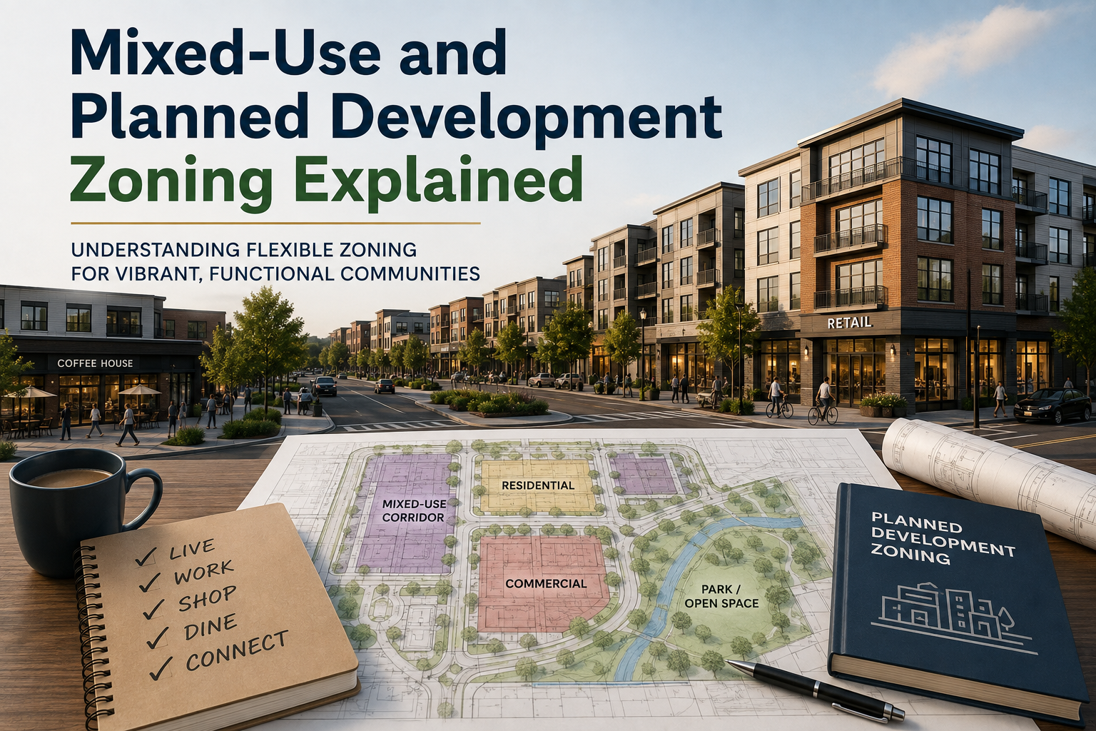
  • Mixed-Use and Planned Development Zoning Explained

    Mixed-Use and Planned Development Zoning Explained

    Zoning Series — Part 4

    Mixed-use and planned development zoning can give Idaho projects more flexibility, but it also makes land-use approval more complex.

    For buyers, builders, and investors in Boise and the Treasure Valley, these zoning categories deserve extra attention because they often involve more than a simple yes-or-no approval. 

    Traditional zoning is usually built around categories. Residential goes here. Commercial goes there. Industrial uses belong somewhere else. Each zoning district comes with its own list of allowed uses, setbacks, height limits, parking rules, and development standards.

    Mixed-use and planned development zoning works differently.

    These zoning tools are often used when a property, project, or neighborhood plan does not fit neatly into one standard zoning box. Instead of applying one broad set of rules to every parcel in a district, the city or county may allow a more tailored approach.

    That flexibility can create high-value projects, walkable neighborhoods, creative site plans, and better use of land. It can also create more review, more conditions, more documentation, and more risk if the approvals are not clearly understood.

    This article explains what mixed-use and planned development zoning allow, how they work, and why buyers, builders, and investors should review these zones carefully before assuming a project is simple.

    What Is Mixed-Use and Planned Development Zoning in Idaho?

    Mixed-use and planned development zoning both allow more flexibility than standard zoning, but they do not work in exactly the same way.

    Mixed-use zoning focuses on combining different land uses in one area, development, or building. A planned development focuses on creating a custom approval plan for a specific site.

    Both can be useful. Both can also be misunderstood.

    A property labeled “mixed-use” or “planned development” may sound wide open, but that does not mean anything can be built there. These zoning tools still have rules. In some cases, they have more rules than a standard residential or commercial district because the approval is tied to a specific plan, layout, phasing schedule, or set of conditions.

    That is the main thing to remember: flexibility does not mean freedom from review.

    What Is Mixed-Use Zoning?

    Mixed-use zoning allows more than one type of land use within the same district, development, site, or building.

    Instead of keeping residential, retail, office, civic, and service uses completely separate, mixed-use zoning allows them to work together in a planned way.

    Common examples include:

    • Apartments over ground-floor retail
    • Offices above commercial storefronts
    • Live-work units
    • Residential buildings near restaurants or services
    • Mixed residential and civic uses
    • Neighborhood-scale commercial space near housing

    This type of zoning is often used in downtown areas, urban centers, transit corridors, redevelopment areas, and places where a city wants a more walkable growth pattern.

    The idea is not just to mix uses randomly. The goal is usually to create places where people can live, work, shop, gather, and access services without every trip requiring a long drive across town.

    For buyers and investors, mixed-use zoning can be attractive because it may create more options for income, future use, or long-term value. But the details matter. The zoning may allow a mix of uses only under certain conditions, in certain locations, or within certain size limits.

    What Is a Planned Development?

    A planned development is different from a standard zoning district because it is usually tied to a specific project or site plan.

    In many places, this is called a Planned Unit Development, or PUD. Some jurisdictions may use terms like Planned Area Development, specific plan district, or planned community. The exact name depends on the local code.

    The basic idea is the same: the property is approved under a customized development plan rather than relying solely on the base zoning standards.

    A planned development may establish its own rules for:

    • Land uses
    • Setbacks
    • Building height
    • Density
    • Lot layout
    • Open space
    • Parking
    • Access
    • Architecture
    • Landscaping
    • Phasing
    • Infrastructure timing

    Once approved, those standards can become the rulebook for that site.

    That can be valuable because it creates predictability for a complex project. It can also be limiting because future owners may be bound by the approved plan, even if market conditions, design preferences, or development goals change later.

    Why Cities Use These Zoning Tools

    Cities and counties do not use mixed-use and planned development zoning just to make the process fancier.

    They use these tools because some projects are too complex for standard zoning to handle well.

    A large redevelopment site, master-planned community, downtown infill project, or mixed residential-commercial development may need more flexibility than a traditional district allows. At the same time, the local government still needs to protect access, traffic flow, infrastructure, neighboring properties, public safety, and long-term land-use goals.

    Mixed-use and planned development zoning can help local governments:

    • Encourage coordinated development
    • Support walkable neighborhoods
    • Allow creative site planning
    • Combine housing, retail, office, and civic uses
    • Guide large projects over time
    • Trade flexibility for public benefits
    • Create clearer expectations for complicated sites

    From a city or county perspective, these tools can reduce uncertainty by reviewing the entire concept up front rather than handling each piece separately later.

    From the buyer or developer perspective, that upfront review can be helpful, but it also means the approval documents matter a lot.

    How Mixed-Use Zoning Regulates Development

    Mixed-use zoning is flexible but still controlled.

    Instead of simply saying “commercial” or “residential,” a mixed-use district may regulate how different uses work together.

    Allowed Uses

    A mixed-use district may identify:

    • Primary uses
    • Secondary uses
    • Accessory uses
    • Conditional uses
    • Prohibited uses

    It may also control where those uses can go.

    For example, retail might be required or encouraged on the ground floor. Residential units may be allowed above. Office space may be allowed in one area of the site but limited in another. Some uses may only be allowed if they do not create traffic, noise, parking, or compatibility problems.

    That means a use can be allowed in the district but still not allowed in the exact way a buyer imagines.

    This is why the use table is only the beginning. The next step is reading the conditions, footnotes, district standards, and any approval documents attached to the property.

    Density and Intensity

    Mixed-use zoning often regulates more than the number of homes.

    It may also look at:

    • Residential units per acre
    • Commercial square footage
    • Office square footage
    • Floor Area Ratio
    • Parking demand
    • Traffic generation
    • Building scale
    • Open space
    • Public space or pedestrian connections

    This matters because mixed-use projects usually balance several pieces at once.

    A project may be allowed to include housing, retail, and office space, but the amount of each use may be limited. The city may also care about how those uses affect traffic, parking, sidewalks, utilities, and nearby neighborhoods.

    For investors, this can change the math. A property may look flexible, but the actual buildout may be controlled by caps, ratios, parking requirements, or infrastructure limits.

    Building Height and Massing

    Mixed-use projects often use more detailed building-form rules than standard districts.

    A zoning district may allow taller buildings in the center of a project but require lower heights near residential edges. It may require step-backs, setbacks, landscaped buffers, or design transitions to reduce the impact on neighboring properties.

    These rules are often called massing controls. In plain language, they shape how big the building feels from the street or from nearby properties.

    That matters because a project may meet the use rules but still need major design changes to meet height, scale, frontage, or compatibility standards.

    How Planned Developments Change the Rules

    Planned developments are where zoning becomes site-specific.

    Instead of relying only on the standard rules for the base district, the approved development plan may create custom standards for that property.

    Custom Development Standards

    A planned development may include custom rules for:

    • Building placement
    • Setbacks
    • Height
    • Density
    • Parking
    • Access points
    • Street layout
    • Open space
    • Architecture
    • Landscaping
    • Signage
    • Phasing

    These standards are usually negotiated through the approval process. Once approved, they may be recorded, adopted, or tied to the property through a development agreement, site plan, or conditions of approval.

    This can be a major benefit when the approved plan matches the buyer’s goals.

    It can also become a problem when a buyer assumes the property complies with normal zoning standards, only to discover that the planned development documents govern what can actually happen.

    Phasing and Long-Term Buildout

    Planned developments often involve more than one phase.

    That is common for larger residential communities, mixed-use centers, commercial projects, or master-planned areas. The project may be designed to build out over several years, or even longer.

    The approval may include rules about:

    • Which phase comes first
    • When roads must be built
    • When utilities must be extended
    • When open space must be installed
    • When commercial areas must be completed
    • How future phases can change

    This is important for buyers because a property may not be ready for the use they have in mind right away. Future phases may depend on infrastructure, market demand, city approvals, or obligations that have not yet been completed.

    Binding Commitments

    A planned development can create obligations that run with the land.

    That means future owners may be bound by the approved plan, design standards, access agreements, open-space requirements, parking rules, or development conditions.

    This can add value by creating certainty. It can also reduce flexibility.

    A buyer may look at a site and think, “I can change this later.” Maybe. But amendments to a planned development often require review and approval. Some changes may be handled administratively, while others may require public hearings or a formal amendment process.

    Before buying into a planned development, buyers should understand what is already approved, what can be changed, and how hard those changes may be.

    Parking, Access, and Infrastructure Matter More Than People Expect

    Mixed-use and planned developments often involve complicated parking and access rules.

    Because different uses have different peak hours, a mixed-use project may be able to share parking. For example, office parking may be used during the day, while residential or restaurant parking demand may peak later.

    That can make the site more efficient, but it usually has to be justified.

    The approval may depend on:

    • Shared parking studies
    • Traffic impact studies
    • Pedestrian connections
    • Transit access
    • Driveway placement
    • Fire access
    • Utility capacity
    • Road improvements
    • Stormwater systems
    • Infrastructure upgrades

    This is where the flexibility can become conditional.

    A project may be allowed to reduce parking or mix uses only if certain access, traffic, or infrastructure assumptions have been approved. If those assumptions change, the project may need additional review.

    For land buyers and investors, this is a big deal. A site that looks flexible on paper may be tied to expensive improvements or strict conditions before it can be built.

    Private Agreements Can Be Just as Important as Zoning

    Mixed-use and planned developments often include private governance layers.

    That may include:

    • Shared access easements
    • Reciprocal parking agreements
    • Common open space
    • Private streets
    • Maintenance agreements
    • Master associations
    • HOAs
    • Condominium regimes
    • Commercial lease restrictions
    • Mixed ownership structures

    These documents can affect how the property is used, maintained, financed, sold, leased, or changed later.

    For example, a commercial tenant may need certain parking rights. A residential owner may be part of an association. A shared driveway may require maintenance contributions. A private street may come with repair obligations. A master development may control signage, architecture, landscaping, or the types of allowed businesses.

    Zoning tells you what the public rules allow. Private documents tell you what the ownership structure allows.

    You need both.

    Common Misconceptions About Mixed-Use and Planned Development Zoning

    Because these zoning tools sound flexible, they are easy to misunderstand.

    Here are a few common misconceptions.

    “It’s flexible, so it must be easier.”

    Not always.

    Flexibility often comes with more review, not less. Mixed-use and planned developments may require more documents, more coordination, more conditions, and more scrutiny than a standard project.

    “Once it’s approved, anything inside the development is allowed.”

    No.

    Only the uses, layouts, standards, and conditions actually approved are protected. If a future owner wants to change the plan, add a new use, increase density, reduce parking, or alter design standards, more review may be required.

    “Planned developments can always be amended.”

    Sometimes they can, but amendments are not automatic.

    A minor change may be simple. A major change may require public hearings, planning commission review, city council or county approval, and updated documents.

    “Base zoning no longer matters.”

    Base zoning may still matter.

    Even when a planned development has custom rules, the base zoning can influence interpretation, allowed uses, enforcement, and what happens when the approved plan is silent on an issue.

    Why These Zones Require Advanced Due Diligence

    Mixed-use and planned development zoning should not be reviewed casually.

    These zones can affect:

    • Project feasibility
    • Financing
    • Appraisal assumptions
    • Construction timing
    • Tenant mix
    • Parking demand
    • Infrastructure costs
    • Ownership structure
    • Resale value
    • Exit strategy
    • Long-term flexibility

    A project that looks flexible on a listing sheet may be tightly controlled by the approved development plan, public conditions, private agreements, or phasing requirements.

    Before buying land, leasing space, financing a project, or planning a buildout, buyers should review the actual approval documents. That may include zoning approvals, development agreements, recorded plats, CC&Rs, easements, parking agreements, site plans, phasing documents, and staff reports.

    This is not the place to rely on “it should be fine.”

    How Mixed-Use and Planned Development Zoning Fit Into the Series

    This part of the zoning series shows the shift from standard zoning to more customized zoning.

    Earlier zoning questions ask, “What district is this property in?” and “What does the code allow?”

    Mixed-use and planned development questions go further:

    • What exact plan was approved?
    • What uses are allowed in each part of the site?
    • What conditions apply?
    • What infrastructure has to be built?
    • What private agreements control the property?
    • What can be changed later?
    • Who has to approve those changes?

    These questions matter because flexibility can be valuable, but only when the buyer understands the rules attached to it.

    The Big Picture

    Mixed-use and planned development zoning can create some of the most interesting and valuable projects in Idaho.

    It can support walkable neighborhoods, creative land use, housing variety, commercial activity, and better long-term planning. It can also create approval conditions, private obligations, phasing requirements, and amendment risks that standard zoning may not involve.

    The opportunity is real. So is the complexity.

    For buyers, builders, and investors in Boise, the Treasure Valley, or elsewhere in Idaho, the safest approach is to read beyond the zoning label. Find the approved plan. Review the conditions. Understand the private agreements. Confirm whether the project works as-is or depends on future changes.

    Zoning may be flexible here, but it is still zoning. The rules just come with more layers.

    Need help making sense of a property before you move forward? Sunrise Realty Group can help you ask the right questions, review the big-picture risks, and understand whether the opportunity fits your goals before you get too far into the process.

    Mixed-use and planned development zoning explained for Idaho buyers, builders, and investors. Learn how Boise and Treasure Valley zoning rules affect land use, PUDs, site plans, approvals, infrastructure, and development flexibility.
  • Land Use and Zoning in Idaho: The First Gate Before You Build

    Part 2 of the series: How the Building Approval Process Actually Works in Idaho

    Land use and zoning are Idaho’s first approval step before design, engineering, permits, or construction.

    Before considering structural calculations or plans, one question matters: Is this kind of building allowed here?

    This question seems simple, but it’s one of the most important questions buyers, builders, or investors can ask.

    If zoning does not permit the proposed use, the project cannot proceed as planned. The quality of the design, the status of financing, or having a builder ready do not matter; the use must first be allowed.

    Many projects encounter issues because people assume zoning labels (like “residential”) permit any such use or that a large parcel supports their intended idea. Zoning specifies much more.

    This article explains what land use and zoning actually control, who enforces those rules, and why this step should be resolved before a buyer spends serious money on plans or moves too far into a purchase.

    What Land Use and Zoning in Idaho Really Control

    Zoning is a legal framework. It is not a casual suggestion or a design preference.

    Local governments use zoning ordinances and zoning maps to divide land into districts. Each district has rules that determine how the land can be used, how intensely it can be developed, and what physical limits apply to structures.

    In plain language, zoning answers questions like:

    • What can be built here?
    • How many units are allowed?
    • How close can the building sit to the property line?
    • How tall can the structure be?
    • How much of the lot can be covered?
    • Does this use require extra approval?
    • Are there overlays or special restrictions on the property?

    Zoning isn’t just about labeling land—it controls critical project details that determine feasibility.

    Buyers, especially land buyers, must check this early. A property can look buildable online, but have zoning limits that change the plan.

    Who Controls Zoning Decisions?

    The property’s location determines the zoning authority.

    Inside city limits, zoning is typically handled by the city’s planning and zoning department. Outside city limits, the county planning department is usually the starting point. In some areas, especially near growing cities, the property may also fall within a city’s impact area or involve more than one reviewing authority.

    The people and boards involved may include:

    • Planning technicians
    • Zoning planners
    • Planning directors
    • Planning and zoning commissions
    • City councils
    • County commissioners

    Not all projects go to every group. If a project clearly meets zoning requirements, it can be handled administratively. More complex projects may require a public hearing, a conditional use permit, a variance, subdivision review, or a rezone.

    Zoning decisions follow a distinct process. A single recommendation doesn’t equal final approval. Buyers must know who has authority, which process applies, and if the answer is just guidance or an actual approval.

    Allowed Uses Come First

    The first thing to check is whether the intended use is allowed.

    Every zoning district has rules that categorize uses. The exact wording varies by jurisdiction, but most use tables to identify uses as:

    • Permitted by right
    • Allowed with conditions
    • Allowed only through a special approval process
    • Prohibited

    This is where many assumptions fall apart.

    A property may allow a single-family home but not a duplex. Another may allow agriculture but limit accessory dwellings. Another may allow a shop only if it is accessory to a primary residence. A home business may be allowed at a basic level, but requires more review if it creates traffic, parking, signage, employees, or customer visits.

    For residential land, zoning may affect whether you can build:

    • A single-family home
    • A duplex or multi-family structure
    • An ADU
    • A detached shop
    • Agricultural buildings
    • A home-based business
    • Multiple dwellings
    • A short-term rental, depending on local rules

    If the intended use isn’t allowed, design considerations like setbacks and floor plans don’t matter until approval is secured.

    Density and Intensity Can Change the Value of Land

    Zoning also controls how intensely land can be developed.

    This is especially important for buyers who are looking at acreage, infill lots, investment property, or land with future subdivision potential. A parcel may appear large enough for several homes, but zoning may permit only one dwelling. Another parcel may support higher density, but only if subdivision, access, utilities, and infrastructure requirements are also met.

    Common density and intensity rules include:

    • Maximum dwelling units per acre
    • Minimum lot size
    • Minimum lot width
    • Minimum frontage
    • Lot coverage limits
    • Open space requirements
    • Parking requirements

    This is where buyers need to be careful with “potential.”

    A listing may state development potential, but only zoning rules and needed approvals determine what is possible, not just the land size.

    Setbacks, Height, and Lot Coverage Shape the Buildable Area

    Even when the use is allowed, zoning still affects where the building can sit and how large it can be.

    Setbacks are the required distances between a structure and the property lines. Most zoning codes include front, side, and rear setbacks. Corner lots may have additional street-side setbacks. Properties near certain roads, waterways, irrigation features, or other uses may have additional buffers.

    Zoning may also control:

    • Maximum building height
    • Maximum lot coverage
    • Accessory structure placement
    • Parking location
    • Driveway access
    • Screening or buffering
    • Open space

    These rules establish the buildable envelope—the area where construction is permitted.

    This is why many areas can be zoned. This is why many areas may be zoned for residential use yet remain difficult to build on. A narrow, irregular, or sloped lot, or one with easements, may technically allow a home but leave very little usable space after restrictions are applied. Buyers  should understand the buildable envelope. Otherwise, they may fall in love with a floor plan that does not actually fit the property.

    Overlay Zones: Add Another Layer

    Base zoning is not always the full story.

    Some properties are affected by overlay zones or special districts. These are extra rules layered on top of the standard zoning district. They may not replace the base zoning, but they can add stricter requirements.

    Common overlays and special restrictions in Idaho may involve:

    • Floodplain or floodway areas
    • Hillside or steep-slope areas
    • Wildland-Urban Interface concerns
    • Airport influence areas
    • Historic or design review districts
    • Planned Unit Developments
    • Wetlands or riparian buffers
    • Sensitive lands

    Overlay rules matter because they often bring additional review, engineering, documentation, or design limits.

    A hillside lot may need slope analysis. A floodplain property may require elevation or floodplain review. A property in a WUI area may raise concerns about fire access or defensible space. A PUD may have its own development standards that differ from the base zoning district.

    Buyers shouldn’t stop at the zoning label. The base district is only part of the story—overlays can change requirements.

    Zoning Approval Is Not Always Automatic

    Some projects clear zoning cleanly. Others need additional steps.

    If the proposed use and design comply with the zoning rules, planning staff may issue zoning clearance or approve the zoning portion administratively. That is the simplest path.

    But many projects are not that simple.

    Depending on the property and the proposal, the owner may need one of several approval pathways.

    Zoning Clearance

    Zoning clearance means the planning department has reviewed the proposal for compliance with zoning requirements. If the use, setbacks, height, lot coverage, parking, and other applicable rules are satisfied, the project may move forward to the next approval layer.

    This is the cleanest result, but it depends on the project fitting the rules as written.

    Variances

    A variance is a request for relief from a zoning standard.

    For example, a property owner may request a reduced setback, increased height, or a lot coverage adjustment. Variances are not automatic, and they are not meant to solve basic preference issues.

    In many jurisdictions, a variance requires the applicant to show hardship or unique property conditions. Wanting a larger building, a better view, or a more convenient layout is usually not enough on its own.

    Conditional Use Permits

    A conditional use permit applies when a zoning district allows a use only if additional review and conditions are satisfied.

    This often involves uses that may be appropriate in some locations but require more scrutiny due to traffic, parking, neighborhood impact, scale, noise, hours of operation, or infrastructure needs.

    Examples may include certain multi-family projects, some accessory structures, expanded home occupations, or uses that do not cleanly fit into a single permitted category.

    Conditional use permits may involve public hearings and discretionary review. That means timeline and outcome risk should be taken seriously.

    Rezoning

    If the desired use is not allowed under the current zoning, the only path may be a rezone.

    Rezoning is a much bigger step. It changes the zoning classification itself and often involves a legislative process. That means public hearings, staff review, political discretion, and no guaranteed outcome.

    For buyers, this is a major risk point. A property that only works if it gets rezoned should be evaluated very differently from a property where the intended use is already allowed.

    Why Zoning Stops So Many Projects

    Zoning stops projects because buyers often treat it as a formality.

    It is not.

    Projects commonly run into trouble because:

    • Buyers assume “residential” means any residential use.
    • Sellers misunderstand or overstate what is allowed.
    • Online parcel data is incomplete or misread.
    • Overlay restrictions are missed.
    • Density assumptions are wrong.
    • Setbacks shrink the usable building area.
    • Variance standards are underestimated.
    • Private restrictions are confused with public zoning.
    • Approval timelines are not factored into the purchase.

    These issues become more painful after money has already been spent.

    A buyer who discovers a zoning problem before closing still has options. A buyer who discovers it after buying the land may be stuck redesigning the project, applying for discretionary approvals, or reconsidering the property’s intended use altogether.

    What Buyers Should Confirm Before Moving Forward

    Before buying land or designing a building, buyers should confirm the zoning basics in writing whenever possible.

    Start with these questions:

    • What is the zoning district?
    • Which jurisdiction controls the property?
    • Is the intended use allowed?
    • Is the use permitted by right or conditional?
    • Are there density limits?
    • What setbacks apply?
    • What height limits apply?
    • Are there overlays or special districts?
    • Does the project need a variance, conditional use permit, or rezone?
    • Are there private restrictions, easements, or plat notes that also affect the property?

    That last question matters because zoning is not the only restriction. Easements, CC&Rs, subdivision notes, title conditions, access agreements, and utility limitations can all affect buildability.

    Zoning is the first gate, but it is not the only gate.

    The Key Takeaway

    Land use and zoning in Idaho should be addressed before buyers get too far into design, financing, permitting, or construction.

    Zoning determines whether the proposed use is allowed. It also shapes density, setbacks, height, lot coverage, overlay review, and the approval path.

    In other words, zoning decides whether the rest of the process is worth pursuing.

    For buyers in Boise, the Treasure Valley, or elsewhere in Idaho, the safest approach is to slow down early. Confirm the zoning district. Read the use table. Ask the planning department the right questions. Understand whether the project is permitted, conditional, or dependent on a higher-risk approval.

    That early work may not feel exciting, but it can prevent expensive redesigns, delayed permits, or a land purchase that does not match the buyer’s actual plan.

    Building in Idaho? Start With Zoning

    If you are buying land, comparing lots, planning a custom home, or exploring a future build in Boise or the Treasure Valley, zoning should be one of the first conversations you have.

    Sunrise Realty Group helps buyers think through those early questions before they get too deep into a purchase or project. From land search and property strategy to builder coordination and local real estate guidance, the goal is simple: fewer surprises, better questions, and a clearer path forward.

    In the next post, we’ll address a closely related issue that surprises many land buyers: whether the lot legally exists, has proper access, and is actually buildable.

    Learn how land use and zoning in Idaho affect building plans, allowed uses, setbacks, overlays, permits, and buildability before you buy land.
  • How to Analyze Zoning Before You Buy Land: A Practical Due Diligence Guide

    Zoning Series — Part 6

    Analyze zoning before buying land in Idaho. A parcel may appear perfect online, but still have limits on what, where, or whether you can build.

    Zoning mistakes are not obvious at first. They usually do not appear in listing photos or a quick conversation with a seller, agent, or neighbor.

    A property may have the right acreage, view, location, and nearby homes. Then deeper questions arise.

    Can you actually build the type of structure you want there? Is the use allowed? Are there setbacks, overlays, easements, or access issues? Would the project require a variance, a conditional use permit, subdivision approval, or a public hearing?

    That is why zoning due diligence is necessary before spending money on plans, surveys, engineering, or design. Zoning is not the only factor in whether land is buildable, but buyers should check it first before committing.

    This guide walks through a practical process for buyers, builders, and investors who want to understand the rules before buying land or designing a project.

    Why You Should Analyze Zoning Before You Buy Land

    Land is marketed in broad, optimistic language like “great building site,” “development potential,” or “ideal for a custom home.”

    Those phrases are not proof.

    They may be accurate, but still must be checked against the property’s zoning, jurisdiction, land-use rules, title, access, utilities, and approvals.

    The goal is not to master zoning overnight but to catch obvious issues early and know when to seek a professional before a small assumption becomes expensive.

    For buyers in Boise, the Treasure Valley, or Idaho, analyze zoning early. Delaying until after closing, design meetings, or builder estimates can turn a fixable issue into a costly problem.

    Step 1: Confirm the Exact Zoning Classification

    Start with the official zoning designation.

    Do not rely on the listing, the seller’s memory, or appearances. Zoning can change from parcel to parcel. One property may have a nonconforming use, a grandfathered structure, or special approval not applicable next door.

    In the beginning, start by confirming three things:

    • The zoning district name
    • The zoning code section
    • The jurisdiction that controls the property

    That last point matters. A property may be in a city, county, or an area where multiple agencies have authority. In the Treasure Valley, this is especially confusing when it comes to limits, impact areas, rural parcels, and properties near growing communities.

    Before you move further, make sure you know whose rules you are reading.

    Step 2: Read the Use Table Before Anything Else

    Once you know the zoning, go straight to the use table.

    Buyers often skip straight to setbacks, building size, or design, but none of them matter if the intended use is not allowed.

    Look for whether your intended use is:

    • Allowed by right
    • Allowed with conditions
    • Allowed only through a special process
    • Not allowed at all

    Check if you can build a single-family home, add an ADU, build a shop, run a home business, add more dwellings, or use it for agriculture, rental, commercial, or mixed use.

    If the use is not explicitly allowed, pause the purchase conversation until you better understand the path forward.

    Sometimes the answer is simple, but other times, it requires a conversation with the planning department or indicates the property does not fit the plan.

    Step 3: Check Density and Lot Requirements

    Acreage alone does not decide what can be built.

    This is a common misunderstanding among buyers. A large parcel may still be limited in the number of homes, units, or lots it can support. Density is governed by zoning, subdivision rules, access, infrastructure, and sometimes health district requirements.

    Check for:

    • Minimum lot size
    • Minimum lot width or frontage
    • Maximum number of dwellings
    • Allowed accessory dwelling units
    • Subdivision rules
    • Lot coverage limits
    • Access or road frontage requirements

    This step is especially important if you are thinking about future development.

    For example, a buyer may see a five-acre parcel and assume it can be split into several lots. Maybe. It depends on zoning, subdivision rules, access, utilities, and approvals.

    “Big enough” is not the same as “allowed.”

    Step 4: Find the Buildable Envelope

    After confirming the use and density rules, figure out where a structure could physically go.

    This is called the buildable envelope. It is the part of the property where construction may be allowed, subject to setbacks and restrictions.

    Review:

    • Front setbacks
    • Side setbacks
    • Rear setbacks
    • Street-side setbacks on corner lots
    • Buffers from other zones or uses
    • Easements
    • Floodplain areas
    • Drainage areas
    • Environmental buffers
    • Irrigation features
    • Access requirements

    A lot that looked wide open may feel much smaller after these checks.

    A property may allow a home, but the buildable area might be limited by setbacks, easements, slopes, flood boundaries, or road access. The best spot may not be legal or practical to build.

    Before designing anything, get a realistic sense of where the structure could sit.

    Step 5: Verify Height and Massing Limits

    Height limits can cause problems late in design if unchecked early.

    This matters for two-story homes, sloped lots, bonus rooms, garages with living space, view properties, and custom designs with taller rooflines.

    Confirm:

    • Maximum building height
    • How height is measured
    • Whether the slope affects the calculation
    • Roof pitch rules
    • Architectural projection limits
    • Accessory structure height limits
    • Any special hillside or design overlay rules

    The phrase “maximum height” sounds simple, but different jurisdictions may measure height differently. Some measure from natural grade. Some use the average grade. Some have special rules for sloped lots or roof types.

    Key takeaway: Check how height is measured to prevent costly design revisions later.

    Step 6: Look for Overlay Zones

    Overlay zones are extra rules added to the base zoning district.

    A property may have standard zoning and still fall under an overlay that changes what can happen.

    Common examples include:

    • Floodplain or floodway areas
    • Hillside or steep-slope overlays
    • Wildfire or fire hazard areas
    • Wetlands or riparian buffers
    • Historic districts
    • Design review areas
    • Airport or noise overlays
    • Sensitive lands

    Overlay zones may not block a project, but can add reviews, reports, engineering, limits, or extra approvals.

    Takeaway: Overlay zones can increase project costs and approval steps, so investigate overlays early.

    A buyer looking at a beautiful hillside lot, river-adjacent parcel, or rural property near open land should be especially careful here. The setting may be exactly what makes the property attractive, but it may also be what triggers extra review.

    Step 7: Review Easements, Plat Notes, and Title Issues

    Zoning shows public rules, not every restriction.

    That is why titles and recorded documents matter.

    Before assuming where you can build, review:

    • The recorded plat
    • Title report
    • Utility easements
    • Drainage easements
    • Access easements
    • Irrigation easements
    • Shared driveway agreements
    • Private road agreements
    • Subdivision notes
    • Survey information, if available

    An easement can block construction even when zoning allows. A plat note may create limits that are easy to miss. Shared road or access issues may affect financing, permitting, or development.

    Takeaway: Professional reviews of title, surveys, and easements help avoid hidden pitfalls.

    Step 8: Check HOA and Private Restrictions

    If in a subdivision or private development, zoning is only part of the story.

    Review the CC&Rs, architectural rules, and design review process before assuming your plan will be allowed.

    An HOA or private review board may control:

    • Exterior materials
    • Roof pitch
    • Fence style
    • Detached shops
    • ADUs
    • Short-term rentals
    • Landscaping
    • Driveway design
    • Outbuilding placement
    • Architectural style

    Private restrictions can be stricter than zoning. They cannot override public rules, but can add approval layers.

    Key takeaway: HOA approval is not guaranteed by public permits; always check private restrictions.

    Step 9: Confirm Utilities and Infrastructure

    Zoning may allow a structure, but infrastructure still dictates what is realistic.

    Before buying land, confirm the practical pieces:

    • Water availability
    • Sewer connection or septic feasibility
    • Power access
    • Gas availability, if needed
    • Road access
    • Fire access
    • Emergency vehicle access
    • Drainage requirements
    • Irrigation considerations
    • Internet or communication service, if important

    Some seem basic until missing.

    A parcel may look affordable because the expensive work has not been done yet. Extending utilities, improving a road, drilling a well, adding a septic system, addressing drainage, or meeting fire access requirements can change the property’s real cost.

    Final takeaway: Combine zoning and infrastructure checks to fully understand project feasibility before buying.

    Step 10: Understand the Approval Path

    The final step is to understand the level of risk built into the approval process.

    Some projects are allowed by right. That usually means the use is permitted if the project meets the applicable standards.

    Other projects require additional review. That may include administrative approval, a conditional use permit, a variance, a subdivision application, a design review, or a public hearing.

    Ask:

    • Does the project require a variance?
    • Is a conditional use permit needed?
    • Will there be a public hearing?
    • Can neighbors appeal?
    • Is subdivision approval required?
    • Is the approval administrative or discretionary?
    • What happens if the request is denied?

    This is where timeline and outcome risk come in.

    A property that only works if several approvals go your way is not the same as a property where the intended use is already allowed. That difference should affect how you evaluate price, timing, financing, and whether the deal makes sense.

    Red Flags That Should Make Buyers Pause

    Not every red flag means “walk away.” Some simply mean “slow down and verify.”

    Be careful when you see:

    • The intended use is not clearly allowed.
    • The plan depends on future rezoning.
    • The seller is relying on what nearby properties have done.
    • The project needs a variance for basic design elements.
    • The listing does not mention overlays.
    • Subdivision potential has not been confirmed.
    • Access is unclear
    • Utilities are assumed but not verified.
    • The buildable area has not been mapped.
    • The phrase “should be fine” is doing too much work.

    That last one matters.

    When land is involved, “probably fine” is not enough. Get the answer in writing from the correct source or bring in the right professional before moving forward.

    When to Bring in Professional Help

    A simple residential lot may only require basic research and a few calls. A more complicated property deserves a deeper review.

    Consider bringing in professional help when:

    • Buying land for development
    • Building on a sloped or constrained lot
    • Planning multiple dwellings
    • Pursuing subdivision
    • Working around floodplain, hillside, or wildfire concerns
    • Relying on a variance or conditional use permit
    • Buying rural acreage
    • Designing a custom home
    • Adding an ADU, shop, or accessory structure
    • Dealing with private roads or shared access

    Depending on the property, that help may come from a real estate professional, land-use planner, surveyor, architect, engineer, builder, attorney, title company, or local planning department.

    Early guidance is almost always cheaper than redesigning later.

    The Big Picture: Zoning Is One Layer of Buildability

    Zoning analysis is not a single checkbox. It is a sequence.

    First, confirm the property’s zoning classification. Then verify the allowed use. From there, check density, setbacks, overlays, easements, utilities, private restrictions, and approval risk.

    That order matters.

    A property can be beautiful yet difficult to build on. It can have acreage and still be limited. It can be zoned residential and still have constraints that affect the design, budget, or timeline.

    The point is not to scare buyers away from land. It is to help them ask sharper questions before they are financially committed.

    Buying Land in Idaho? Start With the Right Questions

    If you are buying land in Boise, the Treasure Valley, or elsewhere in Idaho, zoning should be part of your early due diligence.

    The right property is not just the one that looks good online. It is the one where your intended use, budget, design, timeline, and approval path can work together in the real world.

    Sunrise Realty Group helps buyers think through those questions before they get too far into a purchase or build plan. From land search and zoning conversations to builder coordination and local real estate guidance, the goal is simple: fewer assumptions, fewer surprises, and a clearer path forward.

    Learn how to analyze zoning before you buy land in Idaho, including allowed uses, setbacks, easements, utilities, and approval risks.
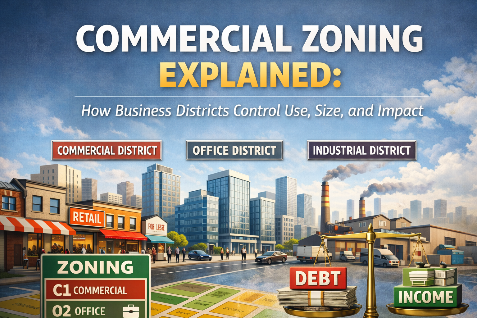
  • Commercial Zoning Explained: How Business Districts Control Use, Size, and Impact

    Commercial Zoning Explained: How Business Districts Control Use, Size, and Impact

    Commercial zoning explained in plain English comes down to this: if a property is zoned for commercial use, the rules become more complex. It is no longer just about what can be built there. It is also about how that business is allowed to operate and how it will interact with traffic, neighbors, utilities, parking, noise, lighting, and public infrastructure.

    That is where misunderstandings get expensive fast.

    Commercial zoning is not just about the structure itself. It is about the intensity of use and the effect it has on the surrounding area. Two properties that both appear “commercial” can have very different allowed uses, development standards, and long-term value.

    For buyers, developers and business owners that matters early. A site may look like a strong fit on paper, but zoning rules may limit the type of business, the number of parking spaces, the placement of the building, or even the hours a property can realistically operate.

    This article breaks down how commercial zoning works, what it regulates, and the issues you need to understand before purchasing or building on a commercially zoned property.

    What Is Commercial Zoning?

    Commercial zoning regulates land intended primarily for business, service and economic activity rather than residential living or agricultural production.

    The goal is not simply to allow “business use.” Local governments use commercial zoning to concentrate business activity in appropriate areas, manage traffic and parking impacts, separate incompatible uses, support economic growth and protect nearby residential neighborhoods.

    That is why commercial zoning does not mean anything business-related can go in the same spot or area. In most jurisdictions, commercial land is divided into multiple subcategories (like residential) each with its own rules, use limitations and development standards.

    Commercial Zoning Explained by District Type

    While zoning varies from one city or county to another, most commercial zoning categories fall into a few recognizable groups.

    Neighborhood or Low-Intensity Commercial

    Often labeled C-1, Neighborhood Commercial, or Local Commercial, these zones are usually intended to serve nearby residential areas.

    Common uses may include small retail shops, coffee shops, professional offices, or personal service businesses such as salons and clinics. Because these areas often sit closer to homes, the rules are usually tighter. Drive-throughs may be restricted. Late-night operations may not be allowed. Building size, signage, and operating hours are often more controlled to reduce neighborhood impact.

    General or Community Commercial

    Often labeled C-2, General Commercial, or Community Commercial, these zones typically allow a broader range of business uses.

    Larger retail stores, restaurants, medical and dental offices, banks, and service businesses are often found in these districts. At this level, traffic generation, parking requirement and access management become major factors. A property may be commercially zoned, but that does not automatically mean every commercial use will be approved the same way.

    Heavy Commercial

    Often labeled C-3, Heavy Commercial, these zones are designed for larger-scale, auto-oriented and higher-traffic uses.

    Hotels, motels, big-box retail, gas stations, auto sales, auto service, and large restaurants or franchise uses often fall into this category. These districts may allow larger buildings, more signage, and extended hours, but they also tend to require more extensive parking, circulation planning and traffic review.

    What Commercial Zoning Regulates

    Commercial zoning controls far more than whether a building can sit on a parcel. It regulates how the site functions, how intense the use can be, and how the property affects the public realm around it.

    Permitted Uses and Use Intensity

    One of the most important parts of commercial zoning is the use table.

    Zoning codes typically categorize businesses into uses allowed by right, uses requiring a conditional use permit and uses prohibited. That distinction matters because two businesses that sound similar in everyday conversation can be treated very differently under zoning rules.

    A small retail shop and a restaurant, for example, may both sound like normal commercial uses. In reality, a restaurant may trigger increased parking demand, increased waste-handling requirements, increased delivery activity and longer operating hours. In commercial zoning, use intensity matters almost as much as use type.

    Parking Requirements

    Parking is one of the most restrictive parts of commercial zoning.

    Requirements are often based on square footage, seating capacity, number of employees or the exact type of business operating on the site. A property can be physically attractive and structurally sound but still become difficult to use if it cannot meet parking standards for the intended tenant or owner.

    Insufficient parking can delay approvals, require shared parking agreements, limit future tenant changes, or reduce resale value. In some cases, a building is not functionally obsolete because of its structure or the site cannot meet modern parking requirements for the use.

    Building Placement and Setbacks

    Commercial zoning also controls where a building can sit on the lot.

    Setbacks may apply to streets, property lines and adjacent residential areas. When a commercial property borders a neighborhood, the zoning code often requires more separation. That may include increased setbacks, landscaped buffer yards, fencing, walls or screening to reduce noise, lighting and visual impact.

    Height and Massing Controls

    Commercial districts often allow more height than residential zones, but height is still regulated.

    Height limits may increase with distance from residential neighborhoods, tighten near residential edges, or be affected by airport overlays, view corridors or other planning restrictions. In many cases, it is not just the number of stories that matters. Building mass, setbacks and overall scale can also shape what is allowed.

    Lot Coverage and Floor Area Ratio (FAR)

    Commercial zoning often uses floor area ratio, or FAR, to control development intensity.

    FAR affects total leasable area, project feasibility, return on investment and future expansion potential. A higher-FAR parcel may support far more value than a similar-looking property in a lower-intensity zone. On the other hand, a low-FAR site can quietly cap development potential even when demand for the location is strong.

    For investors and developers, this is where zoning starts to affect land value in a very real way.

    Traffic, Access and Site Design

    Commercial properties generate traffic and zoning rules reflect that reality.

    Many sites are subject to regulations around driveway spacing, ingress and egress, cross-access, circulation patterns, traffic impact studies or road improvements such as turn lanes and signal work. A zoning district may technically allow a use, but poor access design can keep a project from moving forward smoothly.

    That is one of the biggest differences between simply reading a zoning label and truly understanding a site.

    Easements and Utilities in Commercial Zones

    Commercial properties often contain more site constraints than buyers realize at first glance.

    Utility corridors, drainage easements, access easements, shared driveways and cross-access agreements can all affect layout, buildable area and future flexibility. 

    Do to commercial sites often maximizing lot use, these constraints can significantly reduce usable square footage or complicate redevelopment plans.

    Commercial Zoning Near Residential Areas

    One of the most sensitive zoning transitions is where commercial and residential districts meet.

    In those cases, zoning often imposes reduced height limits, increased setbacks, stronger landscaping buffers, and tighter restrictions on lighting, noise and hours of operation. That means two commercially zoned properties can have very different development potential depending on what surrounds them.

    A commercial parcel on a busy corridor may support a much more intense use than a similar-sized parcel located directly next to homes. The zoning label may look the same, but the practical outcome may not be.

    Common Misconceptions About Commercial Zoning

    Many costly mistakes in commercial real estate start with assumptions that sound reasonable but do not hold up under review.

    One of the biggest is the belief that commercial zoning means any business is allowed. It does not. Use lists are specific and many are more restrictive than buyers expect.

    Another common mistake is assuming that if one business works nearby, another similar business will work on the next parcel. Not necessarily. Parking ratios, site layout, access, adjacency and use intensity can all change the answer.

    It is also a mistake to assume zoning approval guarantees operational success. Zoning may allow a use, but it does not guarantee that the project is practical, efficient, profitable or easy to build.

    Many people underestimate how difficult it can be to convert residential land to commercial use. Rezoning is often political, uncertain and time-consuming.

    Why Commercial Zoning Requires Deeper Analysis

    Commercial zoning affects far more than the label on a map.

    It affects tenant flexibility, parking feasibility, traffic impacts, construction cost, future expansion, long-term property value and investor exit strategy. A site that looks workable for one business may be difficult to lease, resell or repurpose later if the zoning constraints are too narrow.

    That is why zoning mistakes in commercial real estate can turn into six- or seven-figure problems. The risk is not just whether something can be built. The real question is whether the site can support the intended use in a way that is functional, financeable and sustainable.

    For buyers, developers and business owners, commercial zoning should never be treated like a quick box to check. It deserves a closer read before a purchase, a build or a long-term investment decision.

    How Commercial Zoning Fits Into the Bigger Zoning Conversation

    Commercial zoning is where land-use rules start to become more layered.

    It introduces greater complexity, greater regulatory scrutiny and more coordination with public agencies than most residential zoning questions do. It also serves as a bridge to mixed-use districts, planned developments, overlay zones and other advanced land-use frameworks, where the rules become even more detailed.

    Once you understand how commercial zoning controls use, size, intensity and impact, it becomes much easier to judge whether a property is actually a fit for your goals, rather than just commercially labeled in a way that sounds promising.
    If you’re looking at commercial property and want help making sense of zoning, development potentia, or next steps, Sunrise Realty Group is here to help. Reach out to start the conversation.

    Commercial zoning explained in plain English. Learn how business districts regulate use, parking, setbacks, access, and development potential.

  • Agricultural & Rural Zoning Explained: What You Can (and Can’t) Do Outside City Limits

    Agricultural & Rural Zoning Explained: What You Can (and Can’t) Do Outside City Limits

    If residential zoning governs how our neighborhoods actually grow, what about other types of property? Agricultural and rural zoning governs how land stays productive, open, and resource-based.

    These zoning rules shape everything from working farms and ranches to large rural home sites, and they are often misunderstood by buyers moving from residential to rural areas.

    Many people assume that because a property is large, undeveloped, or outside city limits, it must be lightly regulated. In reality, agricultural and rural zoning often comes with very specific local regulations tied to land use, parcel size, subdivision potential, utilities, setback requirements, and non-agricultural uses.

    For buyers, builders, and property owners, understanding the existing zoning classification matters early. A piece of open land may look flexible at first glance. Still, local governments, local ordinances, and the zoning ordinance in a given local jurisdiction can place real limits on what can happen there.

    This article explains how agricultural and rural zoning works, what agricultural and rural zones commonly allow, and the mistakes buyers should avoid before purchasing agricultural property or planning rural development.

    What Is Agricultural and Rural Zoning?

    Agricultural and rural zoning classifications exist to generally aid in the following:

    • Preserve land for farming operations, grazing, and agricultural purposes
    • Prevent premature or overly dense residential development
    • Protect soils, water access, and productive farmland
    • Limit infrastructure strain in rural communities without urban services
    • Support long-term land use planning and reduce urban sprawl

    These different zones usually apply outside incorporated city limits, though some local governments retain agricultural classification inside future growth areas for planning purposes.

    Even though they are often grouped, agricultural and rural zoning are not the same. That distinction matters because the allowed uses, density, and long-term development potential can vary dramatically between an agricultural zoning district and a rural residential zone.

    Agricultural Zoning: Protecting Productive Land

    Agricultural zoning is primarily intended to protect land used for crop production, grazing, and other agricultural activities.

    Common Agricultural Zoning Labels

    Common labels may include:

    • A
    • AG
    • A-1 or A-2
    • Agricultural District
    • Agricultural Zoning District
    • Exclusive Farm Use (in some states)

    Primary Intent of Agricultural Zones

    Agricultural zones are usually meant to prioritize:

    • Crop production
    • Livestock and grazing
    • Irrigation systems and water infrastructure
    • Farm operations and agricultural operations
    • Long-term agricultural land use

    In other words, residential development is often secondary, not primary.

    Residential Use in Agricultural Zones

    In many agricultural zones:

    • A single-family residence or farmhouse may be allowed per parcel
    • Additional dwellings may be limited, restricted, or prohibited
    • Minimum lot size requirements may be very large, such as 10, 20, or 40 acres
    • Residential use may only be allowed when it directly supports agricultural activity or farm operations

    This is one of the biggest misunderstandings buyers run into. Owning agricultural land does not automatically mean you can build multiple homes on it, create residential subdivisions, or treat the parcel like a standard residential zone.

    Subdivision Restrictions in Agricultural Zoning

    Agricultural zoning often includes:

    • Strict limits on parcel splits
    • Large minimum lot size standards are meant to preserve open land
    • Extra review for land development projects
    • Additional approval requirements under local laws or state law

    Even if a parcel is physically large, the zoning regulations may prevent it from being divided into smaller lots without rezoning, a comprehensive plan change, or separate local approval.

    Uses Commonly Allowed in Agricultural Zones

    Commonly allowed uses in agricultural zones may include:

    • Farming operation and crop production
    • Livestock and animal husbandry
    • Farm buildings and agricultural structures
    • Equipment storage
    • Irrigation infrastructure
    • Accessory uses are directly tied to agricultural operations
    • In some areas, a farm market or community garden

    Uses that may be limited or prohibited often include:

    • Dense residential development
    • Non-agricultural uses unrelated to farm operations
    • Commercial retail unrelated to agricultural purposes
    • Certain special uses or event uses
    • Industrial projects or data center developments
    • Short-term rentals or other business models not allowed by local ordinances

    Rural Residential Zoning: Low Density Without Agriculture Requirements

    Rural zoning is often confused with agricultural zoning, but the two serve different purposes.

    Common Rural Residential Labels

    Common labels may include:

    • RR
    • Rural Residential
    • Low-Density Rural
    • Country Residential

    Primary Intent of Rural Zoning

    Rural zoning is generally meant to allow people to live outside urban areas without requiring an active farming operation. These areas are often planned for:

    • Large-lot housing
    • Lower density than residential areas inside cities
    • Limited infrastructure demand
    • A rural lifestyle without full agricultural obligations

    Agriculture may still be allowed, but it is not always the primary use.

    Density and Lot Size in Rural Areas

    Rural residential zoning commonly includes:

    • Larger minimum lot size standards, such as 1, 2, or 5 acres or more
    • Limits on the number of dwellings per parcel
    • Restrictions on clustering or future residential subdivisions
    • Rules tied to septic systems, wells, and access

    Just like in agricultural zones, parcel size does not automatically equal development potential. A 20-acre property may still be limited to one dwelling depending on the zoning ordinance, access, utilities, building codes, and local regulations.

    Zoning Controls That Matter Most in Agricultural and Rural Areas

    Setbacks and height limits still matter, but they are not usually the only rules. There’s a few other guidelines that shape what can actually happen on agricultural and rural land.

    Use Restrictions

    Local governments often regulate:

    • Whether residential use is allowed at all
    • Whether multiple dwellings are permitted
    • Whether non-agricultural uses are allowed
    • Whether special uses, event uses, or short-term rentals are permitted
    • Whether accessory uses must remain tied to agricultural purposes

    Many buyers assume rural areas are flexible. In practice, they often are not.

    Utilities and Infrastructure Limitations

    Agricultural and rural properties often lack:

    • Municipal water
    • Municipal sewer
    • Fire hydrants
    • Urban road standards
    • Nearby utility connections

    As a result, local ordinances or building codes may require:

    • Larger setbacks because of septic systems
    • Fire access compliance
    • Well and septic separation distances
    • Additional review tied to public health and emergency access

    Even if the zoning classification allows a home, infrastructure constraints may still limit where one can build it.

    Easements Are More Common—and More Impactful

    Agricultural landowners and rural property owners often deal with:

    • Irrigation easements
    • Canal or ditch easements
    • Utility corridors
    • Access easements across neighboring land

    These issues can reduce buildable area, affect land use, and change where such buildings can be placed. Zoning should always be reviewed alongside title, access, and utility conditions.

    Height and Structure Limits

    Rural zoning and agricultural zones may allow for larger shops, barns, or outbuildings. But at the end of the day, that does not mean there are no limits. Local rules may still regulate:

    • Maximum building height
    • Total square footage of accessory structures
    • Placement of barns, shops, and farm buildings
    • Fire separation and setback requirements for such uses

    Large agricultural structures may still require permits, compliance review, and approval under local laws.

    Environmental and Resource Overlays

    Agricultural and rural land is also more likely to be affected by overlay rules, such as:

    • Floodplains and floodways
    • Wetlands and riparian buffers
    • Hillside or erosion hazard overlays
    • Fire hazard areas or wildland-urban interface zones

    These overlays can override the base zoning and impose:

    • Larger setbacks
    • Elevated foundation requirements
    • Restrictions on clearing and grading
    • Special construction methods or materials

    The Biggest Misconceptions About Agricultural and Rural Zoning

    “It’s rural, so I can do whatever I want.”

    False. Agricultural and rural zoning often imposes stricter land-use restrictions than buyers expect.

    “Big land means multiple homes.”

    False. Zoning regulations, not acreage alone, control density.

    “I can always split the land later.”

    Often false, in some cases. In agricultural zoning, subdivision is one of the most restricted actions. It’s best to consult with experts.

    “If zoning allows it, permits are automatic.”

    False. Building codes, public health rules, fire access, and other local regulations still apply.

    “If there’s a farmhouse already there, I can add more structures however I want.”

    Not necessarily. Existing improvements do not erase setback requirements, parcel size standards, or limitations on accessory uses.

    Why Agricultural and Rural Zoning Requires Extra Due Diligence

    Agricultural and rural zoning affects:

    • Whether a home can be built at all
    • How many homes are allowed
    • Whether land can be subdivided
    • Whether agricultural activities or non-agricultural uses are permitted
    • Whether a farm market, community garden, or other special uses are allowed
    • Infrastructure cost and feasibility
    • Long-term resale value and exit strategy

    This is where assumptions fail buyers the hardest. A property can look absolutely perfect on paper and still create problems once local jurisdiction rules, access issues, easements, utilities, or setback requirements come into play.

    That is also why buyers looking at land outside city limits benefit from a clear process. Sunrise Realty Group’s 3-One Method helps keep the search focused around one guide, one vision, and one seamless path—especially when zoning, land feasibility, and future plans all need to stay aligned.

    How This Fits Into the Bigger Zoning Picture

    Agricultural and rural zoning are intentionally restrictive. The purpose is to preserve land, manage growth, and protect long-term land use priorities. Even when homes are allowed, these properties do not function the same way as lots inside standard residential areas.

    Understanding agricultural and rural zoning is essential before:

    • Purchasing land
    • Designing a home
    • Planning future development
    • Evaluating agricultural land use
    • Marketing a property for resale

    If you are looking at land outside city limits and want help understanding what a property can realistically support, Sunrise Realty Group can help you evaluate zoning, land use, and next-step feasibility before you make a costly move.

    Agricultural and rural zoning affects what you can build, subdivide, and use outside city limits. Learn the key rules, and land-use limits.