Author: Admin

  • Autism Awareness vs. Acceptance: Why April Matters More Than You Think

    Autism Awareness vs. Acceptance: Why April Matters More Than You Think

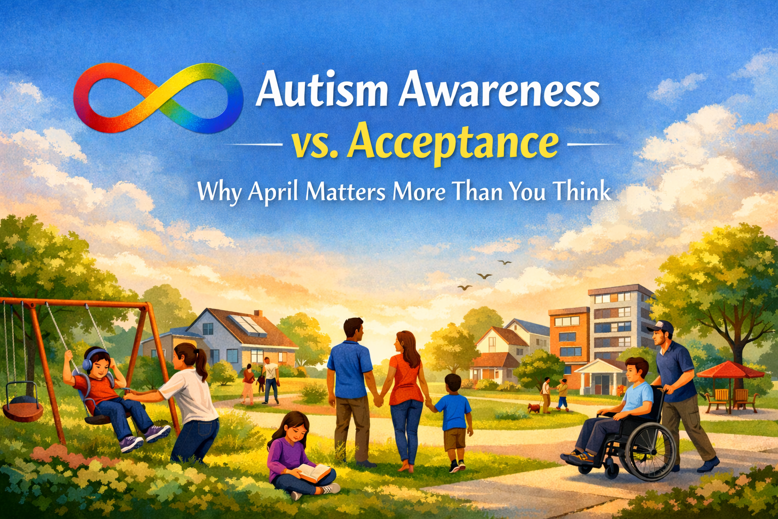
    The month of April as of late, is still widely associated with autism awareness. But more organizations, advocates, and autistic voices now push the conversation further toward autism acceptance. That shift matters  but what is autism awareness vs acceptance?


    Awareness means people know autism exists. ‘Acceptance’ means people are willing to put effort into building spaces, communities, and daily environments where autistic individuals feel respected, included, and supported.


    That distinction is bigger than wording. It changes how people think about schools, workplaces, neighborhoods, and homes. It determines whether someone is merely acknowledged or truly considered when spaces are designed and communities are shaped.


    What Is Autism?

    Autism Spectrum Disorder, or ASD, is a well-known developmental disability that can affect communication, behavior, and social interaction.


    The word spectrum matters because autism does not look the same from one person to the next. Support needs, communication styles, sensitivities, routines, and strengths associated with ASD can vary widely.


    Some autistic people need significant day-to-day support. Others live independently, work, raise families, and move through the world without fitting the stereotypes many people still carry. 


    What they have in common is that they deserve to be understood as people, not reduced to assumptions.


    Autism Awareness vs. Acceptance


    For a long time, April’s conversations centered on awareness. That helped bring autism into public view, but awareness on its own has limits. It can stop at recognition without ever reaching understanding.


    Acceptance asks more of people; shows up in whether schools are supportive, whether workplaces make room for different needs, and whether communities feel welcoming in everyday life. It also means listening to autistic people instead of deciding for them, and over them, what their support should look like.


    That is why acceptance feels different from symbolism. Real acceptance is forever tethered to inclusion, respect, and the way people are treated in real situations, not just the language used around them. Groups like ASAN have helped push that conversation forward by framing acceptance as something lived out in real life.


    The shift from autism awareness vs. acceptance matters. One says, “We know.” The other says, “We are willing to make room.”


    Why This Matters in Real Estate and Community Design


    At first glance, autism acceptance may not seem like a real estate topic. It is.

    Real estate is not just about bedrooms, bathrooms, or square footage. It is also about how a home feels, how a neighborhood functions, and whether a space supports the people living in it. 


    For many families, that includes sensory needs, routine, noise levels, school proximity, traffic patterns, outdoor access, and whether a home feels calming or overstimulating.


    That is part of what makes this conversation so relevant in Boise and across the Treasure Valley. Buyers are not just choosing a property. They are choosing an environment.


    Some buyers may barely notice bright lighting, echo-heavy rooms, or a layout that feels busy. For others, those details can make a home feel draining instead of comfortable.


    The same is true outside the home. A neighborhood with heavy traffic, limited green space, and few quiet spots may feel exciting to one person and overstimulating to another.


    Subjective? Maybe to some. But acceptance means understanding that these differences are real and worth respecting.


    Supportive Home Design Is Not Just a Niche Idea


    Thoughtful design can go a long way for autistic individuals and families, but it also tends to make a home feel better for everyone living there.


    A quiet flex room can offer a place to reset. Natural light often feels softer than harsh overhead lighting.


    Better insulation can help cut down on noise. A layout that feels straightforward can make daily life less stressful. And when storage keeps clutter under control, the whole home can feel calmer and easier to manage.


    This isn’t targeted at adding unnecessary extras, it’s more about creating a home that feels more livable day to day.


    This is one reason home design deserves more attention in conversations about inclusion.


    Buyers are not only asking what a home looks like; they are also asking what a home feels like. They are asking how it works, how it feels, and whether it supports the life that actually happens inside it.


    Community Matters Too


    Acceptance does not, and should not, stop at your front door.


    A supportive community may include access to parks, quieter streets, walkability, nearby services, and environments that do not feel constantly overwhelming. Finding a property within said community may mean thinking beyond just basic ‘curb appeal’ and asking harder questions about what daily life in a neighborhood will actually be like.


    That is especially important for families who are already navigating sensory sensitivities, changing routines, or educational and support needs. A home can be beautiful on paper and still be the wrong fit if the surrounding environment makes everyday life harder.


    Real estate professionals do not need to pretend to be clinicians or experts in autism to understand this. But they should be thoughtful enough to recognize that families experience homes differently, and that good guidance sometimes means paying attention to more than the listing sheet.


    The Shift Away From the Puzzle Piece


    This conversation also shows up in the symbols people use to represent autism.


    For a long time, the puzzle piece was commonly associated with autism. But many autistic people and advocates have said it feels outdated or uncomfortable, especially because it can suggest that something is missing or needs to be fixed.


    The infinity symbol has become a more widely accepted alternative. It reflects diversity, inclusion, and the wide range of autistic experiences. That change mirrors the larger shift away from simple awareness and toward acceptance.


    Even choices like symbols, language, and imagery can say a lot. They help shape whether people feel respected and understood, or misunderstood before the conversation even begins.


    Building Better Communities Starts With Understanding


    At Sunrise Realty Group, we believe home is deeply personal. It is not just where you sleep. It is where routines happen, where families regulate stress, where kids grow up, and where people should feel safe being fully themselves.


    That is one reason this conversation belongs in real estate.


    When we talk about autism acceptance, we are also talking about how communities are built, how homes are chosen, and whether the environments around us are designed with real people in mind.


    Awareness may be where the conversation starts, but acceptance is where it begins to matter.


    Final Thoughts


    Autism Acceptance Month is a reminder that inclusion should not stop with April. It should carry into the way we think about people, homes, and the communities we live in all year long.


    A lot of the conversation around acceptance comes back to understanding, inclusion, and real support. That is a stronger approach than simply acknowledging autism without changing how people are treated.


    In real estate, that matters more than some people realize. It affects the questions we ask, the homes we point people toward, and the communities we help families become part of. When we think more carefully about what makes a home feel safe, comfortable, and functional, we are doing more than helping someone buy a house.


    We help them find a place where they can truly belong.

    Autism Awareness vs Acceptance: April is a reminder that inclusion isn’t a trend—it’s a responsibility. Choose Acceptance


  • Why Do We Have the Easter Bunny and Egg Hunts? The History Behind Easter Traditions

    Why Do We Have the Easter Bunny and Egg Hunts? The History Behind Easter Traditions

    Every spring, families far and wide celebrate Easter with dyed eggs, baskets, and backyard games. And of course, who could forget the familiar image of the Easter Bunny? For many of us, those traditions feel so normal that we never stop to ask where they came from. The story behind the Easter Bunny and egg hunts is older and more layered than most people realize.

    Easter is a Christian holiday centered on resurrection, hope, and new life. At the same time, many of the customs people now associate with the season were shaped by older spring traditions, cultural folklore, and family celebrations that changed over time. When you look at the history of Easter traditions, you can see how religious meaning, seasonal symbolism, and community rituals gradually blended into one holiday.

    The Meaning of Easter and the Connection to Spring

    At its core, Easter marks the resurrection of Jesus Christ and carries strong themes of renewal, hope, and new beginnings. That message already fits naturally with spring, when colder weather begins to lift, and the landscape starts to change again.

    It is easy to see why that connection has lasted. Spring has always been tied to growth, fresh starts, and life returning after winter. Trees begin to bud, lawns green up, and people start coming back outside. Because of that, it made sense for Easter traditions to absorb symbols that already represented rebirth and abundance.

    That is one reason the history of Easter traditions does not come from a single source. The holiday itself has a clear Christian meaning, but some of the symbols surrounding it originated in older customs later adopted into Easter celebrations.

    Why Eggs Became Part of Easter Traditions

    Long before folks dyed Easter eggs in bright colors or hid them in the grass, eggs already carried strong symbolic meaning. In many cultures around the world, eggs represented life, fertility, and the start of new beginnings. That symbolism made them a natural fit for spring festivals; a time full of new life and new beginnings.

    As Christianity spread across Europe, eggs took on added significance in Easter traditions. They became associated with new life and resurrection, which helped connect an older seasonal symbol to the Christian message of Easter. Over time, that symbolic link stuck.

    There was also a practical reason eggs became part of the holiday. During Lent, many Christians historically avoided foods like meat, dairy, and eggs. When Easter arrived, eggs became part of the celebration again. People would boil, preserve, decorate, and serve them as part of the feast.

    Over time, these decorated eggs, once simple now elaborately adorned with color, moved from a meaningful seasonal food to one of the most recognizable Easter traditions.

    That shift helps explain why eggs still hold such a central place in Easter today. Even in modern celebrations, they continue to symbolize renewal, family tradition, and the arrival of spring.

    Where the Easter Bunny Came From

    The origin of the Easter Bunny is one of the most curious parts of the holiday. The bunny itself does not come from the biblical Easter story. Instead, it appears to come from European folklore, tied to spring and fertility.

    Before the modern Easter Bunny took shape, the hare was already a strong seasonal symbol in parts of Europe. Because rabbits and hares reproduce quickly, they became associated with abundance, fertility, and the energy of spring. That made them an easy fit for celebrations centered on the season.

    The version most people recognize today is often connected to German folklore. In that tradition, parents told children about an Easter hare, sometimes called the Osterhase, that would leave eggs for them to find.

    When German immigrants brought that custom to early America, the story gradually changed and spread. The hare became a bunny, the custom became more child-focused, and the Easter Bunny grew into a nationwide symbol of the holiday.

    That evolution is part of what makes the Easter Bunny’s history so interesting. It was not created all at once. It developed over generations as traditions moved between countries, families, and communities.

    How Easter Egg Hunts Became a Tradition

    The story of egg hunts makes even more sense once you connect eggs and the Easter hare. If children were already being told that a magical hare left eggs behind, it was only natural for families to turn that idea into an activity.

    At first, the tradition was simple. Adults hid eggs, children searched for them, and the act itself became part of the celebration. Over time, that custom grew into organized egg hunts at homes, churches, parks, and community events. What may have started as a small folk tradition eventually became one of the most familiar Easter activities in the United States.

    There are a few reasons egg hunts became so popular. They are easy to organize, fun for kids, and flexible enough to work in almost any setting. They also fit the holiday’s emotional tone. Easter is tied to joy, family, and fresh beginnings, and egg hunts give people a playful way to experience that together.

    Today, the tradition may look a little different. Some families use real dyed eggs, while others hide plastic eggs filled with candy or toys. But the basic idea has stayed the same, which is why Easter Bunny and egg hunts still feel so connected in the modern celebration.

    The History of Easter Traditions Is a Blend, Not One Single Story

    One reason people ask why we have the Easter Bunny and egg hunts is that the traditions can feel unrelated at first glance. But when you look at them historically, they begin to fit together.

    Easter itself carries Christian meaning centered on resurrection and hope. Eggs have long symbolized life and rebirth. The hare came from European spring folklore. Egg hunts grew from the custom of children searching for eggs left by the Easter hare. Over time, those pieces blended into one holiday tradition that families still recognize today.

    That is really the best way to understand the history of Easter traditions. It is not a straight line. It is a layered story shaped by religion, folklore, seasonal customs, and family practice.

    Why These Easter Traditions Still Matter Today

    Even now, Easter tends to mark a shift in the year. In places like Boise, Meridian, Eagle, and across the Treasure Valley, spring brings people back outdoors and fills the calendar with family events, local celebrations, and neighborhood gatherings. Easter often lands right in the middle of that seasonal reset.

    That is part of why these traditions still continue to resonate. They are not only about the past. They also reflect what people still want from this time of year: connection, renewal, and a sense of forward movement.

    Whether someone is planning a family gathering, taking on spring projects, or thinking about a fresh start, Easter arrives at a moment when many people are already looking ahead.

    Final Thoughts on the Easter Bunny and Egg Hunts

    So, why do we have the Easter Bunny and egg hunts?

    Easter traditions were shaped over time by multiple influences. The religious meaning of Easter, the symbolism of eggs, the folklore of the spring hare, and the joy of family celebration all came together to create the holiday people know today.

    That is why the Easter Bunny still shows up every spring. That is why egg hunts remain a favorite tradition. And that is why Easter continues to feel like more than just one day on the calendar. For many families, it still represents renewal, celebration, and the start of a new season.

    Thinking About a Fresh Start This Spring?

    Spring has a way of getting people to think about what comes next. Sometimes that means cleaning up a yard, showing up for community events, or making new plans for the months ahead. Sometimes it means thinking bigger.

    If this season has you thinking about a fresh start in Boise or anywhere in the Treasure Valley, Sunrise Realty Group is here to help you take the next step with confidence.

    Learn the history behind the Easter Bunny and egg hunts, and how Easter traditions grew from faith, folklore, and springtime celebration.

  • Introducing the Builder Plan Licensing Program by The Sunrise Realty Group

    Introducing the Builder Plan Licensing Program by The Sunrise Realty Group

    A New Approach to Residential Plan Access for Builders

    At The Sunrise Realty Group, we are always looking for ways to better support builders, developers, and real estate professionals throughout the Treasure Valley.

    Recently, MC Design House joined The Sunrise Realty Group, allowing our companies to work together more closely and provide a broader range of services for the residential construction industry. By bringing residential design and real estate services together under one umbrella, we are able to offer builders a more streamlined experience when planning and developing new homes.

    Today we are excited to introduce a new program designed specifically for builders who regularly construct repeatable homes.

    The Builder Plan Licensing Program

    The Builder Plan Licensing Program is a new approach to how builders access residential construction plans.

    For more than 30 years, MC Design House has been designing homes throughout the Treasure Valley. During that time we have worked with a wide range of builders and have gained valuable insight into how plans are actually used in the construction process.

    What we have learned is that many builders often rely on a set of proven home designs that can be built repeatedly with little or no modification. However, the traditional process requires purchasing a new plan each time a project begins.

    The Builder Plan Licensing Program changes that.

    Instead of purchasing plans individually for every project, builders enrolled in the program gain access to a curated selection of residential designs that can be deployed across multiple projects through a simple licensing structure.

    Our goal is to make the process faster, more predictable, and more cost-effective for builders who construct multiple homes each year.


    How the Program Works

    Beginning May 1st, builders who enroll in the Builder Plan Licensing Program will gain access to a curated selection of residential home plans.

    Builders can deploy these plans across their projects during the term of the program using plan licenses.

    Each builder will be able to deploy up to 12 plan licenses during the six-month program term.

    Each license allows the builder to construct one home using a plan from the Builder Plan Library.

    Builders have flexibility in how those licenses are used. Licenses can be used for upcoming projects as needed, deployed multiple times in a single month or spread out across the full six-month term

    At the end of the six-month period, builders may renew their participation in the program for another term.

    This structure allows builders to maintain flexibility while keeping design costs predictable.


    Program Tiers

    The Builder Plan Licensing Program is offered in four tiers, based on the size of the homes being constructed.

    Each tier provides access to plans within a specific square-footage range.


    Tier 1

    Plans up to 2,000 square feet

    $3,000 per month
    6-month term

    Total available licenses: 12 homes


    Tier 2

    Plans up to 3,000 square feet

    $4,500 per month
    6-month term

    Total available licenses: 12 homes


    Tier 3

    Plans up to 4,000 square feet

    $6,000 per month
    6-month term

    Total available licenses: 12 homes


    Tier 4

    Plans larger than 4,000 square feet

    Pricing for Tier 4 plans will be determined based on the specific needs of the builder and the types of homes being constructed.


    Additional Licensing Option

    Builders who anticipate a higher volume of projects can expand their plan usage within the program.

    For an additional $1,000 per month, builders can increase their allowance to 18 total plan licenses during the six-month term.

    This option allows builders who are producing a higher number of homes to maintain the same streamlined licensing structure while increasing their deployment capacity.


    Program Launch

    Enrollment for the Builder Plan Licensing Program begins May 1st.

    Builders interested in participating in the program are encouraged to reach out to learn more about how the program works and determine which tier best fits their construction needs.

    We are always looking for ways to provide additional value to our builder partners, and we believe this program offers a unique opportunity to streamline the plan process while reducing overall design costs.

    If you would like to learn more or reserve a spot in the program, please feel free to contact us.

    We look forward to continuing to support the builders who are shaping the future of housing in the Treasure Valley.

  • Agricultural & Rural Zoning Explained: What You Can (and Can’t) Do Outside City Limits

    Agricultural & Rural Zoning Explained: What You Can (and Can’t) Do Outside City Limits

    If residential zoning governs how our neighborhoods actually grow, what about other types of property? Agricultural and rural zoning governs how land stays productive, open, and resource-based.

    These zoning rules shape everything from working farms and ranches to large rural home sites, and they are often misunderstood by buyers moving from residential to rural areas.

    Many people assume that because a property is large, undeveloped, or outside city limits, it must be lightly regulated. In reality, agricultural and rural zoning often comes with very specific local regulations tied to land use, parcel size, subdivision potential, utilities, setback requirements, and non-agricultural uses.

    For buyers, builders, and property owners, understanding the existing zoning classification matters early. A piece of open land may look flexible at first glance. Still, local governments, local ordinances, and the zoning ordinance in a given local jurisdiction can place real limits on what can happen there.

    This article explains how agricultural and rural zoning works, what agricultural and rural zones commonly allow, and the mistakes buyers should avoid before purchasing agricultural property or planning rural development.

    What Is Agricultural and Rural Zoning?

    Agricultural and rural zoning classifications exist to generally aid in the following:

    • Preserve land for farming operations, grazing, and agricultural purposes
    • Prevent premature or overly dense residential development
    • Protect soils, water access, and productive farmland
    • Limit infrastructure strain in rural communities without urban services
    • Support long-term land use planning and reduce urban sprawl

    These different zones usually apply outside incorporated city limits, though some local governments retain agricultural classification inside future growth areas for planning purposes.

    Even though they are often grouped, agricultural and rural zoning are not the same. That distinction matters because the allowed uses, density, and long-term development potential can vary dramatically between an agricultural zoning district and a rural residential zone.

    Agricultural Zoning: Protecting Productive Land

    Agricultural zoning is primarily intended to protect land used for crop production, grazing, and other agricultural activities.

    Common Agricultural Zoning Labels

    Common labels may include:

    • A
    • AG
    • A-1 or A-2
    • Agricultural District
    • Agricultural Zoning District
    • Exclusive Farm Use (in some states)

    Primary Intent of Agricultural Zones

    Agricultural zones are usually meant to prioritize:

    • Crop production
    • Livestock and grazing
    • Irrigation systems and water infrastructure
    • Farm operations and agricultural operations
    • Long-term agricultural land use

    In other words, residential development is often secondary, not primary.

    Residential Use in Agricultural Zones

    In many agricultural zones:

    • A single-family residence or farmhouse may be allowed per parcel
    • Additional dwellings may be limited, restricted, or prohibited
    • Minimum lot size requirements may be very large, such as 10, 20, or 40 acres
    • Residential use may only be allowed when it directly supports agricultural activity or farm operations

    This is one of the biggest misunderstandings buyers run into. Owning agricultural land does not automatically mean you can build multiple homes on it, create residential subdivisions, or treat the parcel like a standard residential zone.

    Subdivision Restrictions in Agricultural Zoning

    Agricultural zoning often includes:

    • Strict limits on parcel splits
    • Large minimum lot size standards are meant to preserve open land
    • Extra review for land development projects
    • Additional approval requirements under local laws or state law

    Even if a parcel is physically large, the zoning regulations may prevent it from being divided into smaller lots without rezoning, a comprehensive plan change, or separate local approval.

    Uses Commonly Allowed in Agricultural Zones

    Commonly allowed uses in agricultural zones may include:

    • Farming operation and crop production
    • Livestock and animal husbandry
    • Farm buildings and agricultural structures
    • Equipment storage
    • Irrigation infrastructure
    • Accessory uses are directly tied to agricultural operations
    • In some areas, a farm market or community garden

    Uses that may be limited or prohibited often include:

    • Dense residential development
    • Non-agricultural uses unrelated to farm operations
    • Commercial retail unrelated to agricultural purposes
    • Certain special uses or event uses
    • Industrial projects or data center developments
    • Short-term rentals or other business models not allowed by local ordinances

    Rural Residential Zoning: Low Density Without Agriculture Requirements

    Rural zoning is often confused with agricultural zoning, but the two serve different purposes.

    Common Rural Residential Labels

    Common labels may include:

    • RR
    • Rural Residential
    • Low-Density Rural
    • Country Residential

    Primary Intent of Rural Zoning

    Rural zoning is generally meant to allow people to live outside urban areas without requiring an active farming operation. These areas are often planned for:

    • Large-lot housing
    • Lower density than residential areas inside cities
    • Limited infrastructure demand
    • A rural lifestyle without full agricultural obligations

    Agriculture may still be allowed, but it is not always the primary use.

    Density and Lot Size in Rural Areas

    Rural residential zoning commonly includes:

    • Larger minimum lot size standards, such as 1, 2, or 5 acres or more
    • Limits on the number of dwellings per parcel
    • Restrictions on clustering or future residential subdivisions
    • Rules tied to septic systems, wells, and access

    Just like in agricultural zones, parcel size does not automatically equal development potential. A 20-acre property may still be limited to one dwelling depending on the zoning ordinance, access, utilities, building codes, and local regulations.

    Zoning Controls That Matter Most in Agricultural and Rural Areas

    Setbacks and height limits still matter, but they are not usually the only rules. There’s a few other guidelines that shape what can actually happen on agricultural and rural land.

    Use Restrictions

    Local governments often regulate:

    • Whether residential use is allowed at all
    • Whether multiple dwellings are permitted
    • Whether non-agricultural uses are allowed
    • Whether special uses, event uses, or short-term rentals are permitted
    • Whether accessory uses must remain tied to agricultural purposes

    Many buyers assume rural areas are flexible. In practice, they often are not.

    Utilities and Infrastructure Limitations

    Agricultural and rural properties often lack:

    • Municipal water
    • Municipal sewer
    • Fire hydrants
    • Urban road standards
    • Nearby utility connections

    As a result, local ordinances or building codes may require:

    • Larger setbacks because of septic systems
    • Fire access compliance
    • Well and septic separation distances
    • Additional review tied to public health and emergency access

    Even if the zoning classification allows a home, infrastructure constraints may still limit where one can build it.

    Easements Are More Common—and More Impactful

    Agricultural landowners and rural property owners often deal with:

    • Irrigation easements
    • Canal or ditch easements
    • Utility corridors
    • Access easements across neighboring land

    These issues can reduce buildable area, affect land use, and change where such buildings can be placed. Zoning should always be reviewed alongside title, access, and utility conditions.

    Height and Structure Limits

    Rural zoning and agricultural zones may allow for larger shops, barns, or outbuildings. But at the end of the day, that does not mean there are no limits. Local rules may still regulate:

    • Maximum building height
    • Total square footage of accessory structures
    • Placement of barns, shops, and farm buildings
    • Fire separation and setback requirements for such uses

    Large agricultural structures may still require permits, compliance review, and approval under local laws.

    Environmental and Resource Overlays

    Agricultural and rural land is also more likely to be affected by overlay rules, such as:

    • Floodplains and floodways
    • Wetlands and riparian buffers
    • Hillside or erosion hazard overlays
    • Fire hazard areas or wildland-urban interface zones

    These overlays can override the base zoning and impose:

    • Larger setbacks
    • Elevated foundation requirements
    • Restrictions on clearing and grading
    • Special construction methods or materials

    The Biggest Misconceptions About Agricultural and Rural Zoning

    “It’s rural, so I can do whatever I want.”

    False. Agricultural and rural zoning often imposes stricter land-use restrictions than buyers expect.

    “Big land means multiple homes.”

    False. Zoning regulations, not acreage alone, control density.

    “I can always split the land later.”

    Often false, in some cases. In agricultural zoning, subdivision is one of the most restricted actions. It’s best to consult with experts.

    “If zoning allows it, permits are automatic.”

    False. Building codes, public health rules, fire access, and other local regulations still apply.

    “If there’s a farmhouse already there, I can add more structures however I want.”

    Not necessarily. Existing improvements do not erase setback requirements, parcel size standards, or limitations on accessory uses.

    Why Agricultural and Rural Zoning Requires Extra Due Diligence

    Agricultural and rural zoning affects:

    • Whether a home can be built at all
    • How many homes are allowed
    • Whether land can be subdivided
    • Whether agricultural activities or non-agricultural uses are permitted
    • Whether a farm market, community garden, or other special uses are allowed
    • Infrastructure cost and feasibility
    • Long-term resale value and exit strategy

    This is where assumptions fail buyers the hardest. A property can look absolutely perfect on paper and still create problems once local jurisdiction rules, access issues, easements, utilities, or setback requirements come into play.

    That is also why buyers looking at land outside city limits benefit from a clear process. Sunrise Realty Group’s 3-One Method helps keep the search focused around one guide, one vision, and one seamless path—especially when zoning, land feasibility, and future plans all need to stay aligned.

    How This Fits Into the Bigger Zoning Picture

    Agricultural and rural zoning are intentionally restrictive. The purpose is to preserve land, manage growth, and protect long-term land use priorities. Even when homes are allowed, these properties do not function the same way as lots inside standard residential areas.

    Understanding agricultural and rural zoning is essential before:

    • Purchasing land
    • Designing a home
    • Planning future development
    • Evaluating agricultural land use
    • Marketing a property for resale

    If you are looking at land outside city limits and want help understanding what a property can realistically support, Sunrise Realty Group can help you evaluate zoning, land use, and next-step feasibility before you make a costly move.

    Agricultural and rural zoning affects what you can build, subdivide, and use outside city limits. Learn the key rules, and land-use limits.

  • What the FEMA Flood Map Really Means — and How It Affects Your Property, Loan, and Insurance

    What the FEMA Flood Map Really Means — and How It Affects Your Property, Loan, and Insurance

    If you’ve ever heard a lender, insurance agent, or real estate professional say “according to the FEMA flood map,” you might assume it’s simply a reference to general flood risk.

    In reality, the FEMA flood map is the official flood hazard map used across the United States to determine flood risk, flood insurance requirements, construction standards, and lending decisions. For property owners, misunderstanding what the FEMA flood map shows can affect insurance costs, financing approval, and even the feasibility of new construction.

    For buyers, builders, and landowners, a property’s position on the FEMA flood map can influence everything from required flood insurance policies to foundation design and base flood elevations.

    Let’s break down what the FEMA flood map actually is, who regulates it, how it affects loans and insurance, and what property owners can do if the map does not accurately reflect their property’s flood risk.

    What the FEMA Flood Map Is (Flood Insurance Rate Map – FIRM)

    When professionals refer to the FEMA flood map, they are almost always referring to the Flood Insurance Rate Map (FIRM).

    The FIRM is what’s known as the official flood map of a community used by the Federal Emergency Management Agency (FEMA) to identify flood hazards and determine flood insurance requirements under the National Flood Insurance Program (NFIP).

    These flood hazard maps are the authoritative source used by lenders, insurance providers, builders, and local governments.

    A FEMA flood map (FIRM) is used to:

    • Identify Special Flood Hazard Areas (SFHAs)
    • Assign flood zones (A, AE, AO, VE, X, etc.)
    • Establish Base Flood Elevations (BFEs)
    • Define specific areas with the highest risk of flooding
    • Support risk assessments and flood insurance pricing
    • Guide current development standards for new construction

    The effective flood maps for each community are publicly available through the FEMA Flood Map Service Center, where property owners can search by street address and review their community’s flood risk.

    GIS overlays and local flood hazard layers may be useful planning tools. Still, the effective FEMA flood map remains the official map of a community with legal authority for lending and insurance decisions.

    How the FEMA Flood Map Is Created and Regulated

    The Federal Emergency Management Agency manages flood mapping nationwide as part of the National Flood Insurance Program.

    Federal law requires FEMA to conduct flood insurance studies, analyze water flow, and publish flood hazard maps that reflect a community’s flood risk.

    Flood mapping involves extensive technical work, including:

    • Hydraulic analyses of rivers and drainage areas
    • Detailed analyses of flood patterns and flood waters
    • Measurement of average flood depths
    • Identification of base floodplain elevations
    • Modeling of storm surge and flooding in coastal areas

    This information forms the basis for digital flood insurance rate maps (DFIRMs) and the National Flood Hazard Layer, which integrates flood hazard data across the United States.

    FEMA frequently updates these maps through programs such as Risk MAP, working with local governments, community officials, and Cooperating Technical Partner programs to incorporate improved data and flood hazard information.

    In many communities, updated flood studies include:

    • Sea level rise modeling
    • Changes in drainage areas
    • New rainfall patterns and heavy rains
    • Urban development impacts
    • Revised average depths and water flow calculations

    Because flood conditions evolve, communities periodically receive preliminary flood hazard data or preliminary FIRMs before new maps become effective.

    How the FEMA Flood Map Defines Flood Risk

    The FEMA flood map is designed to identify areas with a measurable probability of flooding.

    The most widely recognized floodplain classification is the 100-year flood, which refers to a 1% (percent) annual chance of actual flooding in any given year.

    Areas inside this boundary are classified as Special Flood Hazard Areas (SFHAs) and represent high-risk flood zones.

    Common SFHA zones on the FEMA flood map include:

    • Zone A
    • Zone AE
    • Zone AO
    • Zone AH
    • Zone VE (coastal high-risk flood zone)

    These zones represent actual locations where flood waters are most likely to reach structures, often requiring more stricter building standards and of course, mandatory flood insurance.

    Zones labeled X represent moderate risk or minimal flood risk areas. While insurance may still be recommended, these areas generally do not trigger mandatory insurance for federally backed loans.

    Flood risk categories are actually based on several key factors, including:

    • Base flood elevations
    • Average flood depths
    • Water velocity
    • Storm surge exposure in coastal communities
    • Flash floods in smaller drainage basins

    Even outside high-risk areas, flood damage remains one of the most common natural disasters in the United States, which is why FEMA encourages property owners to understand their community’s flood risk even when insurance is not required.

    Why the FEMA Flood Map Triggers Mandatory Flood Insurance

    The FEMA flood map is directly tied to federal lending rules.

    When a structure is located in a Special Flood Hazard Area, and the mortgage is federally backed — such as FHA, VA, or many conventional loans — lenders must enforce mandatory flood insurance purchase requirements.

    This requirement exists to protect both homeowners and the federal mortgage system from catastrophic flood losses.

    Flood insurance policies may be issued through:

    National Flood Insurance Program (NFIP)

    FEMA handles the National Flood Insurance Program. For many it still remains the most widely accepted coverage option.

    NFIP policies:

    • Are backed by the federal government
    • Are sold by private insurance companies under FEMA rules
    • Are accepted by all lenders nationwide

    Standard coverage limits include:

    • $250,000 for residential structures
    • $100,000 for contents

    NFIP policies follow consistent underwriting rules tied directly to FEMA flood maps, base flood elevations, and flood insurance rates established through flood insurance studies.

    Private Flood Insurance

    Private flood insurance carriers increasingly offer alternatives to NFIP coverage.

    Private policies may provide:

    • Higher coverage limits
    • Coverage for additional living expenses
    • Expanded protection for basements or detached structures

    However, lenders must confirm that private policies meet federal compliance requirements, which is why NFIP coverage remains the default option for many mortgage lenders.

    How the FEMA Flood Map Affects Property Owners and New Construction

    For property owners and builders, the FEMA flood map influences much more than insurance, especially when planning new construction.

    FEMA flood maps can also help determine:

    • Minimum finished floor elevations
    • Foundation design requirements
    • Use of necessary flood vents
    • Placement of fill material
    • Permitting timelines
    • Appraisal conditions
    • Overall development feasibility

    Construction projects located within high-risk flood zones often require additional engineering review, elevation certificates, and compliance with local floodplain regulations enforced by a local floodplain administrator.

    In many cases, two properties located only a short distance apart may face dramatically different construction costs if one lies inside a base floodplain. At the same time, the other falls outside the official flood map boundary.

    Understanding a property’s flood zone early in the buying process can prevent costly surprises during permitting or loan underwriting.

    How to Use the FEMA Flood Map Service Center to Check Your Property

    Property owners and buyers can review their property’s flood hazard information through the FEMA Flood Map Service Center.

    This database provides:

    • The official flood map for each community
    • Access to digital flood insurance rate maps
    • Historical flood hazard maps and flood hazard boundary maps
    • Flood insurance studies and technical reports
    • Information about the effective date of each map panel

    By entering a street address, users can view the community’s flood map, identify flood zones, and access additional information about floodplain boundaries.

    Can a FEMA Flood Map Be Challenged?

    In some situations, the FEMA flood map may not accurately reflect a property’s elevation or flood risk.

    Property owners may request formal revisions through Letters of Map Change (LOMC).

    Some of the most common processes include:

    • LOMA – Letter of Map Amendment
    • LOMR – Letter of Map Revision
    • CLOMR – Conditional Letter of Map Revision

    These requests most typically require:

    • A certified elevation certificate
    • Engineering analysis
    • Surveyed elevation data
    • FEMA review and approval

    When successful, a letter of map change can remove a property from a higher-risk flood zone, eliminate mandatory insurance requirements, and improve resale value.

    The Bottom Line on the FEMA Flood Map

    The FEMA flood map is the official tool used to identify flood risk across communities in the United States.

    It determines:

    • Which areas are classified as Special Flood Hazard Areas
    • Where mandatory flood insurance applies
    • How properties must be built or elevated
    • How lenders assess flood risk during financing

    For buyers, builders, and property owners, understanding how the FEMA flood map works can prevent delays, unexpected insurance costs, and construction challenges.

    Talk With Sunrise Realty Group About Flood Risk Before You Buy

    Flood zones can affect financing, insurance requirements, and what can realistically be built on a property. Knowing what you’re getting yourself into is a smart move.

    Checking the FEMA flood map early is wise, especially when purchasing land, rural acreage, or property near waterways.

    At Sunrise Realty Group, we help buyers review flood hazard information, understand how it may impact lending and insurance, and look at potential issues before a transaction moves a little too far down the road to turn back.

    If you’re evaluating land or a home purchase and need another set of eyes on the FEMA flood map, reach out to Sunrise Realty Group andwe’ll walk through the details with you.


    Contact Sunrise Realty Group today to discuss your next property purchase with confidence.

    What the FEMA flood map means for property owners. Learn how flood zones affect insurance, loans, construction rules, and more